
P57A Homestead Farm, Martinsburg, WV, USA - Earthquake Result Viewer
| ||||||||||||||||||
| ||||||||||||||||||
| ||||||||||||||||||
|
Signal To Noise
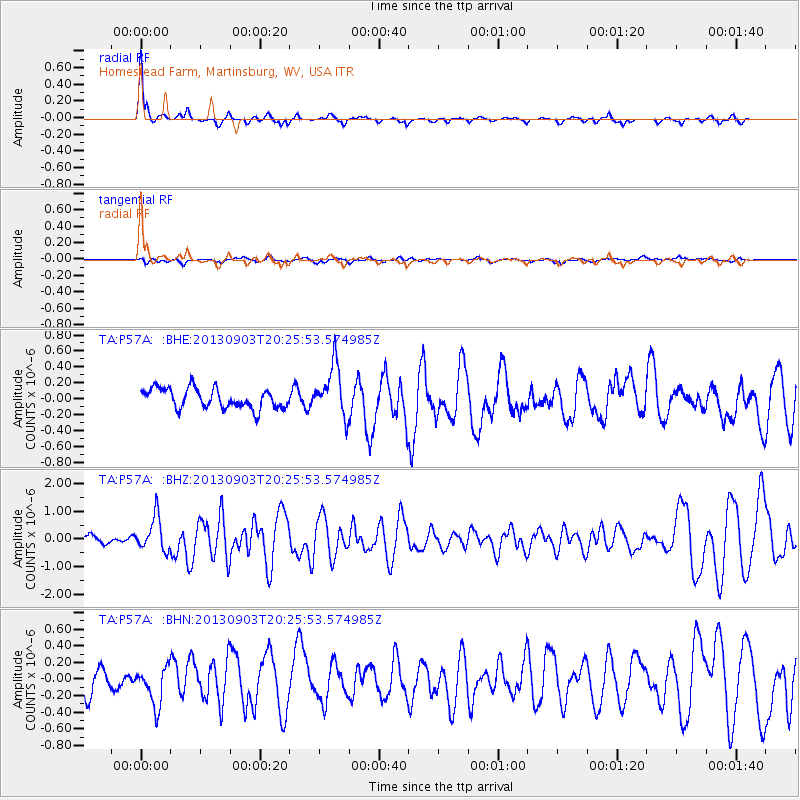
| Channel | StoN | STA | LTA |
| TA:P57A: :BHZ:20130903T20:25:53.574985Z | 3.8207335 | 6.142085E-7 | 1.6075668E-7 |
| TA:P57A: :BHN:20130903T20:25:53.574985Z | 1.7479848 | 2.3644166E-7 | 1.352653E-7 |
| TA:P57A: :BHE:20130903T20:25:53.574985Z | 2.6330082 | 3.2830167E-7 | 1.2468692E-7 |
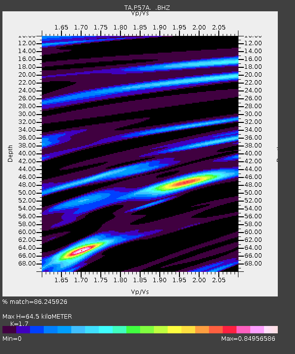
| Arrivals | |
| Ps | 7.9 SECOND |
| PpPs | 26 SECOND |
| PsPs/PpSs | 34 SECOND |

