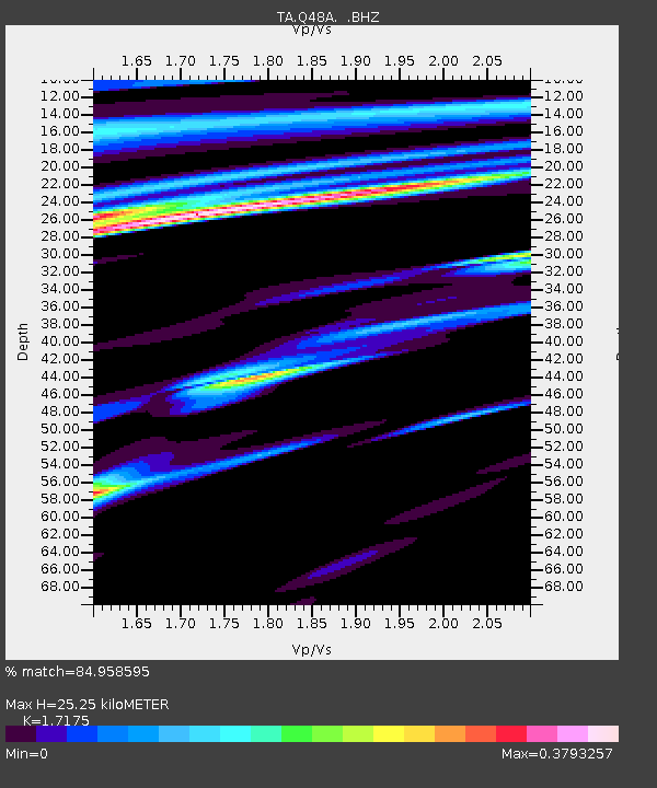
Q48A North Vernon, IN, USA - Earthquake Result Viewer
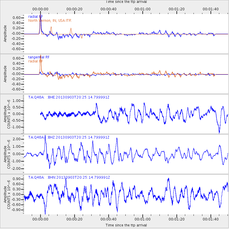
Earthquake location: Queen Charlotte Islands Region
Earthquake latitude/longitude: 51.2/-130.4
Earthquake time(UTC): 2013/09/03 (246) 20:19:06 GMT
Earthquake Depth: 2.7 km
Earthquake Magnitude: 6.1 MWW, 6.0 MWB, 6.1 MWW, 6.1 MWC, 6.2 MI, 6.2 MWC
Earthquake Catalog/Contributor: NEIC PDE/NEIC COMCAT
Network: TA USArray Transportable Network (new EarthScope stations)
Station: Q48A North Vernon, IN, USA
Lat/Lon: 38.93 N/85.73 W
Elevation: 185 m
Distance: 33.3 deg
Az: 93.974 deg
Baz: 306.493 deg
Ray Param: 0.078267545
Estimated Moho Depth: 25.25 km
Estimated Crust Vp/Vs: 1.72
Assumed Crust Vp: 6.498 km/s
Estimated Crust Vs: 3.783 km/s
Estimated Crust Poisson's Ratio: 0.24
Radial Match: 84.958595 %
Radial Bump: 400
Transverse Match: 65.24429 %
Transverse Bump: 400
SOD ConfigId: 626651
Insert Time: 2014-04-18 08:44:47.325 +0000
GWidth: 2.5
Max Bumps: 400
Tol: 0.001

Signal To Noise

ChannelStoNSTALTA
TA:Q48A: :BHZ:20130903T20:25:14.799991Z5.4738998.86491E-71.6194873E-7
TA:Q48A: :BHN:20130903T20:25:14.799991Z3.02219254.2901138E-71.4195369E-7
TA:Q48A: :BHE:20130903T20:25:14.799991Z2.65219243.1811157E-71.1994288E-7
Arrivals
Ps3.0 SECOND
PpPs9.7 SECOND
PsPs/PpSs13 SECOND