
R49A Shelbyville, KY, USA - Earthquake Result Viewer
| ||||||||||||||||||
| ||||||||||||||||||
| ||||||||||||||||||
|
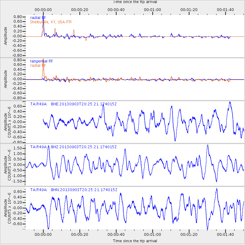
Signal To Noise
| Channel | StoN | STA | LTA |
| TA:R49A: :BHZ:20130903T20:25:21.174015Z | 5.1238317 | 7.1735167E-7 | 1.4000297E-7 |
| TA:R49A: :BHN:20130903T20:25:21.174015Z | 4.2835274 | 3.4967996E-7 | 8.163365E-8 |
| TA:R49A: :BHE:20130903T20:25:21.174015Z | 2.5751808 | 3.1273703E-7 | 1.2144275E-7 |
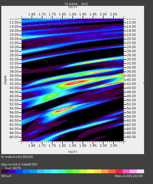
| Arrivals | |
| Ps | 7.3 SECOND |
| PpPs | 22 SECOND |
| PsPs/PpSs | 29 SECOND |

