
R50A Paris, KY, USA - Earthquake Result Viewer
| ||||||||||||||||||
| ||||||||||||||||||
| ||||||||||||||||||
|
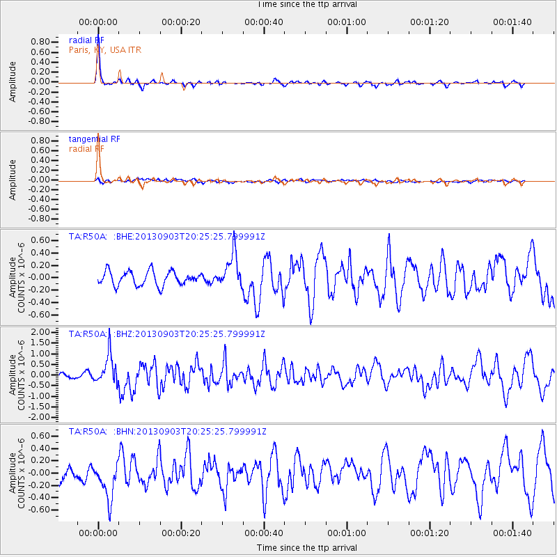
Signal To Noise
| Channel | StoN | STA | LTA |
| TA:R50A: :BHZ:20130903T20:25:25.799991Z | 7.199893 | 7.159712E-7 | 9.944193E-8 |
| TA:R50A: :BHN:20130903T20:25:25.799991Z | 3.673136 | 3.2709562E-7 | 8.905078E-8 |
| TA:R50A: :BHE:20130903T20:25:25.799991Z | 2.5330882 | 2.8742272E-7 | 1.1346732E-7 |
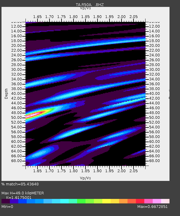
| Arrivals | |
| Ps | 5.1 SECOND |
| PpPs | 18 SECOND |
| PsPs/PpSs | 23 SECOND |

