R56A Bull Pasture Mountain, McDowell, VA, USA - Earthquake Result Viewer
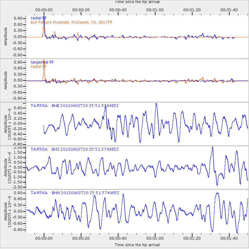
Earthquake location: Queen Charlotte Islands Region
Earthquake latitude/longitude: 51.2/-130.4
Earthquake time(UTC): 2013/09/03 (246) 20:19:06 GMT
Earthquake Depth: 2.7 km
Earthquake Magnitude: 6.1 MWW, 6.0 MWB, 6.1 MWW, 6.1 MWC, 6.2 MI, 6.2 MWC
Earthquake Catalog/Contributor: NEIC PDE/NEIC COMCAT
Network: TA USArray Transportable Network (new EarthScope stations)
Station: R56A Bull Pasture Mountain, McDowell, VA, USA
Lat/Lon: 38.41 N/79.40 W
Elevation: 902 m
Distance: 37.6 deg
Az: 89.598 deg
Baz: 306.866 deg
Ray Param: 0.07605041
Estimated Moho Depth: 41.25 km
Estimated Crust Vp/Vs: 1.63
Assumed Crust Vp: 6.159 km/s
Estimated Crust Vs: 3.778 km/s
Estimated Crust Poisson's Ratio: 0.20
Radial Match: 85.53688 %
Radial Bump: 326
Transverse Match: 54.965237 %
Transverse Bump: 400
SOD ConfigId: 626651
Insert Time: 2014-04-18 08:45:31.391 +0000
GWidth: 2.5
Max Bumps: 400
Tol: 0.001

Signal To Noise

ChannelStoNSTALTA
TA:R56A: :BHZ:20130903T20:25:51.574985Z3.96064425.378619E-71.3580163E-7
TA:R56A: :BHN:20130903T20:25:51.574985Z1.5946311.6719547E-71.04849E-7
TA:R56A: :BHE:20130903T20:25:51.574985Z1.69982463.2126542E-71.8899917E-7
Arrivals
Ps4.5 SECOND
PpPs16 SECOND
PsPs/PpSs21 SECOND