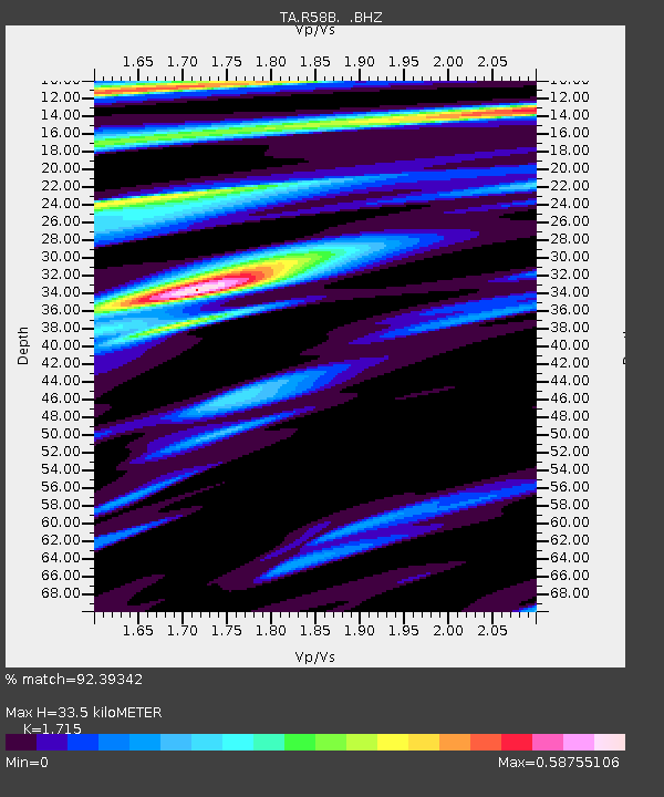
R58B Mineral, VA, USA - Earthquake Result Viewer
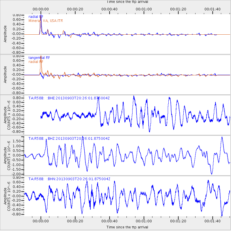
Earthquake location: Queen Charlotte Islands Region
Earthquake latitude/longitude: 51.2/-130.4
Earthquake time(UTC): 2013/09/03 (246) 20:19:06 GMT
Earthquake Depth: 2.7 km
Earthquake Magnitude: 6.1 MWW, 6.0 MWB, 6.1 MWW, 6.1 MWC, 6.2 MI, 6.2 MWC
Earthquake Catalog/Contributor: NEIC PDE/NEIC COMCAT
Network: TA USArray Transportable Network (new EarthScope stations)
Station: R58B Mineral, VA, USA
Lat/Lon: 37.96 N/77.88 W
Elevation: 116 m
Distance: 38.9 deg
Az: 88.997 deg
Baz: 307.333 deg
Ray Param: 0.07534095
Estimated Moho Depth: 33.5 km
Estimated Crust Vp/Vs: 1.72
Assumed Crust Vp: 6.565 km/s
Estimated Crust Vs: 3.828 km/s
Estimated Crust Poisson's Ratio: 0.24
Radial Match: 92.39342 %
Radial Bump: 295
Transverse Match: 72.09468 %
Transverse Bump: 400
SOD ConfigId: 626651
Insert Time: 2014-04-18 08:45:36.289 +0000
GWidth: 2.5
Max Bumps: 400
Tol: 0.001

Signal To Noise

ChannelStoNSTALTA
TA:R58B: :BHZ:20130903T20:26:01.875004Z6.45546256.313335E-79.779833E-8
TA:R58B: :BHN:20130903T20:26:01.875004Z2.91278172.7512152E-79.4453185E-8
TA:R58B: :BHE:20130903T20:26:01.875004Z3.1875823.5058386E-71.0998426E-7
Arrivals
Ps3.9 SECOND
PpPs13 SECOND
PsPs/PpSs17 SECOND