You are here: Home > Network List > TA - USArray Transportable Network (new EarthScope stations) Stations List
> Station S49A Springfield, KY, USA > Earthquake Result Viewer
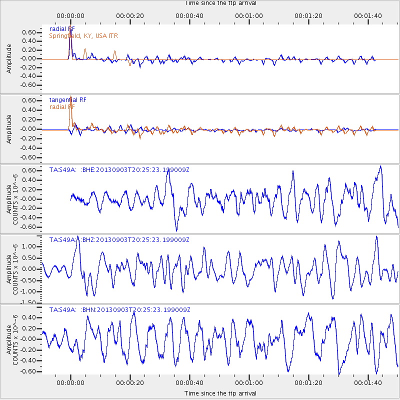
S49A Springfield, KY, USA - Earthquake Result Viewer
*The percent match for this event was below the threshold and hence no stack was calculated.
| Earthquake location: |
Queen Charlotte Islands Region |
| Earthquake latitude/longitude: |
51.2/-130.4 |
| Earthquake time(UTC): |
2013/09/03 (246) 20:19:06 GMT |
| Earthquake Depth: |
2.7 km |
| Earthquake Magnitude: |
6.1 MWW, 6.0 MWB, 6.1 MWW, 6.1 MWC, 6.2 MI, 6.2 MWC |
| Earthquake Catalog/Contributor: |
NEIC PDE/NEIC COMCAT |
|
| Network: |
TA USArray Transportable Network (new EarthScope stations) |
| Station: |
S49A Springfield, KY, USA |
| Lat/Lon: |
37.78 N/85.29 W |
| Elevation: |
230 m |
|
| Distance: |
34.3 deg |
| Az: |
95.232 deg |
| Baz: |
307.812 deg |
| Ray Param: |
$rayparam |
*The percent match for this event was below the threshold and hence was not used in the summary stack. |
|
| Radial Match: |
73.10195 % |
| Radial Bump: |
228 |
| Transverse Match: |
41.97579 % |
| Transverse Bump: |
310 |
| SOD ConfigId: |
626651 |
| Insert Time: |
2014-04-18 08:45:43.028 +0000 |
| GWidth: |
2.5 |
| Max Bumps: |
400 |
| Tol: |
0.001 |
|
Signal To Noise
| Channel | StoN | STA | LTA |
| TA:S49A: :BHZ:20130903T20:25:23.199009Z | 5.498444 | 7.1307903E-7 | 1.2968742E-7 |
| TA:S49A: :BHN:20130903T20:25:23.199009Z | 1.6919657 | 1.9631747E-7 | 1.1602923E-7 |
| TA:S49A: :BHE:20130903T20:25:23.199009Z | 2.7741566 | 3.0482198E-7 | 1.0987916E-7 |
| Arrivals |
| Ps | |
| PpPs | |
| PsPs/PpSs | |


