S50A Richmond, KY, USA - Earthquake Result Viewer
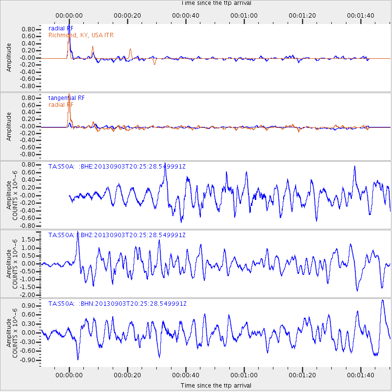
Earthquake location: Queen Charlotte Islands Region
Earthquake latitude/longitude: 51.2/-130.4
Earthquake time(UTC): 2013/09/03 (246) 20:19:06 GMT
Earthquake Depth: 2.7 km
Earthquake Magnitude: 6.1 MWW, 6.0 MWB, 6.1 MWW, 6.1 MWC, 6.2 MI, 6.2 MWC
Earthquake Catalog/Contributor: NEIC PDE/NEIC COMCAT
Network: TA USArray Transportable Network (new EarthScope stations)
Station: S50A Richmond, KY, USA
Lat/Lon: 37.68 N/84.40 W
Elevation: 300 m
Distance: 34.9 deg
Az: 94.619 deg
Baz: 307.849 deg
Ray Param: 0.077504486
Estimated Moho Depth: 57.0 km
Estimated Crust Vp/Vs: 1.89
Assumed Crust Vp: 6.476 km/s
Estimated Crust Vs: 3.426 km/s
Estimated Crust Poisson's Ratio: 0.31
Radial Match: 86.45045 %
Radial Bump: 348
Transverse Match: 59.329117 %
Transverse Bump: 400
SOD ConfigId: 626651
Insert Time: 2014-04-18 08:45:47.530 +0000
GWidth: 2.5
Max Bumps: 400
Tol: 0.001

Signal To Noise

ChannelStoNSTALTA
TA:S50A: :BHZ:20130903T20:25:28.549991Z5.7315726.977449E-71.2173709E-7
TA:S50A: :BHN:20130903T20:25:28.549991Z3.64724873.2127764E-78.808767E-8
TA:S50A: :BHE:20130903T20:25:28.549991Z2.75929053.5715155E-71.2943602E-7
Arrivals
Ps8.4 SECOND
PpPs24 SECOND
PsPs/PpSs32 SECOND