
S52A Salyersville, KY, USA - Earthquake Result Viewer
| ||||||||||||||||||
| ||||||||||||||||||
| ||||||||||||||||||
|
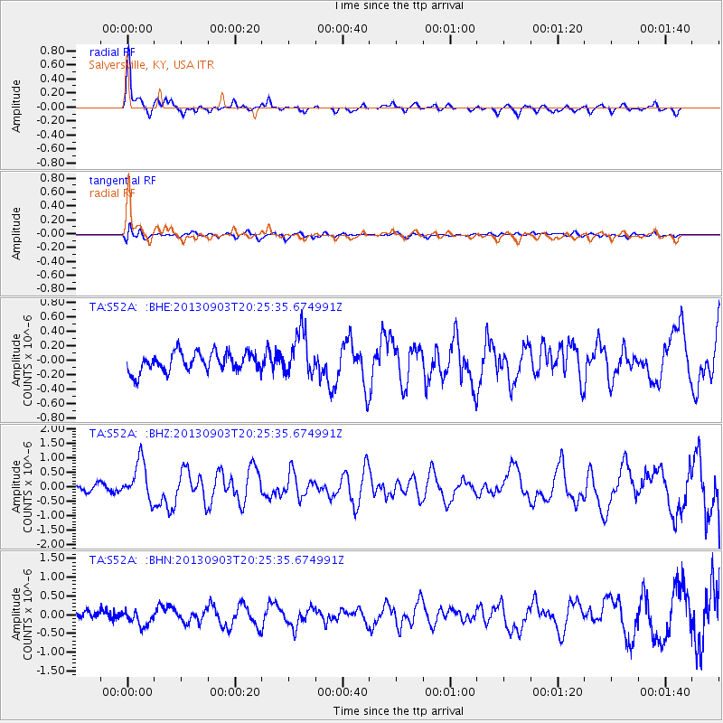
Signal To Noise
| Channel | StoN | STA | LTA |
| TA:S52A: :BHZ:20130903T20:25:35.674991Z | 5.919276 | 6.742216E-7 | 1.1390271E-7 |
| TA:S52A: :BHN:20130903T20:25:35.674991Z | 2.224216 | 2.116075E-7 | 9.513801E-8 |
| TA:S52A: :BHE:20130903T20:25:35.674991Z | 2.2752068 | 2.9995198E-7 | 1.3183504E-7 |
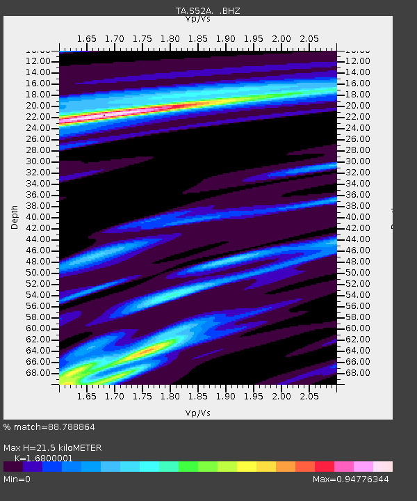
| Arrivals | |
| Ps | 2.4 SECOND |
| PpPs | 8.2 SECOND |
| PsPs/PpSs | 11 SECOND |

