S56A Natural Bridge, VA, USA - Earthquake Result Viewer
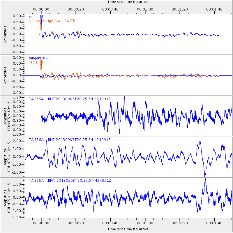
Earthquake location: Queen Charlotte Islands Region
Earthquake latitude/longitude: 51.2/-130.4
Earthquake time(UTC): 2013/09/03 (246) 20:19:06 GMT
Earthquake Depth: 2.7 km
Earthquake Magnitude: 6.1 MWW, 6.0 MWB, 6.1 MWW, 6.1 MWC, 6.2 MI, 6.2 MWC
Earthquake Catalog/Contributor: NEIC PDE/NEIC COMCAT
Network: TA USArray Transportable Network (new EarthScope stations)
Station: S56A Natural Bridge, VA, USA
Lat/Lon: 37.68 N/79.57 W
Elevation: 449 m
Distance: 38.0 deg
Az: 90.671 deg
Baz: 307.615 deg
Ray Param: 0.07585369
Estimated Moho Depth: 15.75 km
Estimated Crust Vp/Vs: 1.72
Assumed Crust Vp: 6.419 km/s
Estimated Crust Vs: 3.727 km/s
Estimated Crust Poisson's Ratio: 0.25
Radial Match: 86.958984 %
Radial Bump: 400
Transverse Match: 58.599426 %
Transverse Bump: 400
SOD ConfigId: 626651
Insert Time: 2014-04-18 08:46:01.425 +0000
GWidth: 2.5
Max Bumps: 400
Tol: 0.001

Signal To Noise

ChannelStoNSTALTA
TA:S56A: :BHZ:20130903T20:25:54.424991Z5.3486417.456612E-71.3941134E-7
TA:S56A: :BHN:20130903T20:25:54.424991Z1.76150772.9901602E-71.6975005E-7
TA:S56A: :BHE:20130903T20:25:54.424991Z2.40806373.5493562E-71.4739462E-7
Arrivals
Ps1.9 SECOND
PpPs6.2 SECOND
PsPs/PpSs8.1 SECOND