
T50A Nancy, KY, USA - Earthquake Result Viewer
| ||||||||||||||||||
| ||||||||||||||||||
| ||||||||||||||||||
|
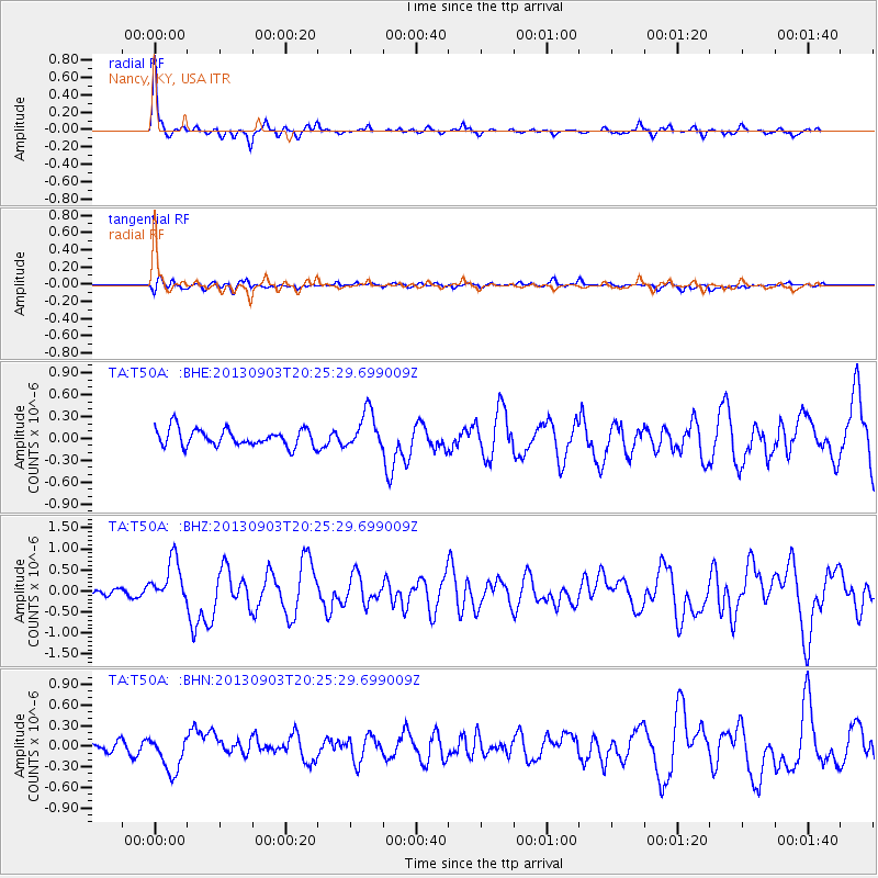
Signal To Noise
| Channel | StoN | STA | LTA |
| TA:T50A: :BHZ:20130903T20:25:29.699009Z | 5.926694 | 5.1971466E-7 | 8.769048E-8 |
| TA:T50A: :BHN:20130903T20:25:29.699009Z | 3.4739032 | 2.6897112E-7 | 7.74262E-8 |
| TA:T50A: :BHE:20130903T20:25:29.699009Z | 2.1601896 | 2.5437953E-7 | 1.1775796E-7 |
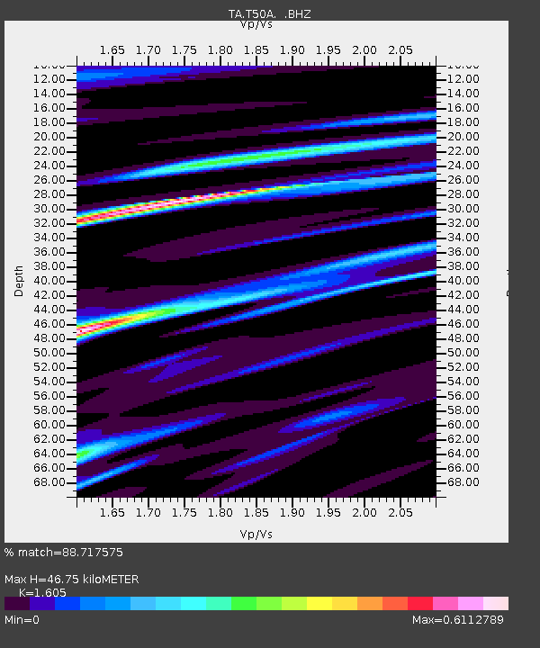
| Arrivals | |
| Ps | 4.8 SECOND |
| PpPs | 17 SECOND |
| PsPs/PpSs | 22 SECOND |

