
T57A Hurt, VA, USA - Earthquake Result Viewer
| ||||||||||||||||||
| ||||||||||||||||||
| ||||||||||||||||||
|
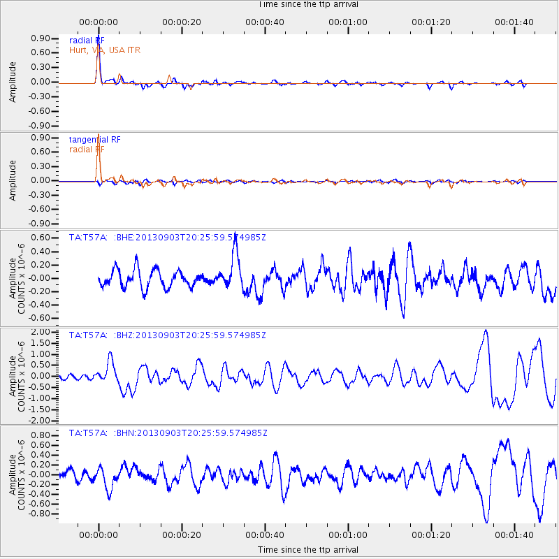
Signal To Noise
| Channel | StoN | STA | LTA |
| TA:T57A: :BHZ:20130903T20:25:59.574985Z | 4.2307234 | 4.954112E-7 | 1.1709846E-7 |
| TA:T57A: :BHN:20130903T20:25:59.574985Z | 1.8141664 | 2.1934181E-7 | 1.2090501E-7 |
| TA:T57A: :BHE:20130903T20:25:59.574985Z | 2.1371446 | 2.764862E-7 | 1.2937177E-7 |
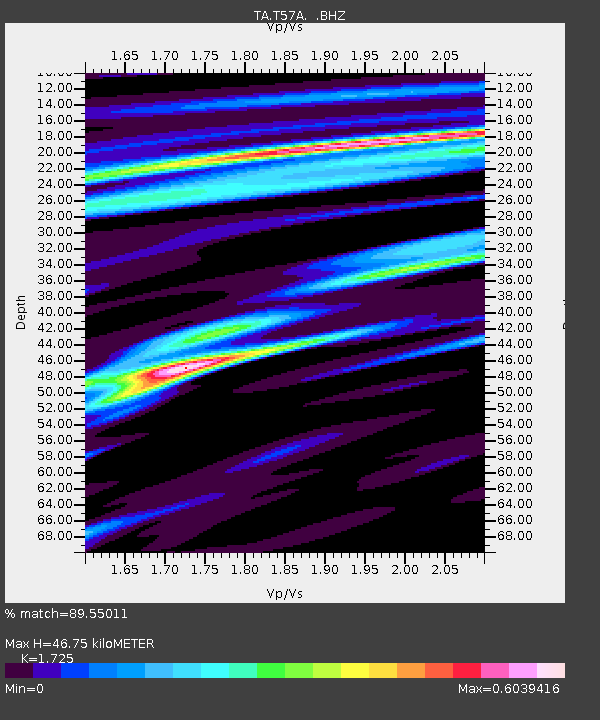
| Arrivals | |
| Ps | 5.7 SECOND |
| PpPs | 18 SECOND |
| PsPs/PpSs | 24 SECOND |

