
U52A Thorn Hill, TN, USA - Earthquake Result Viewer
| ||||||||||||||||||
| ||||||||||||||||||
| ||||||||||||||||||
|
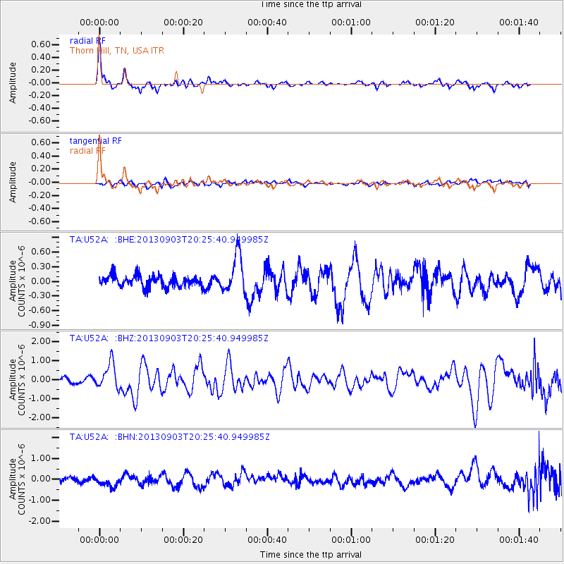
Signal To Noise
| Channel | StoN | STA | LTA |
| TA:U52A: :BHZ:20130903T20:25:40.949985Z | 5.5322514 | 6.925209E-7 | 1.2517886E-7 |
| TA:U52A: :BHN:20130903T20:25:40.949985Z | 2.2961295 | 2.7308252E-7 | 1.18931666E-7 |
| TA:U52A: :BHE:20130903T20:25:40.949985Z | 3.3875659 | 3.9363144E-7 | 1.16198905E-7 |
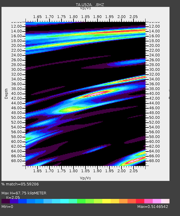
| Arrivals | |
| Ps | 12 SECOND |
| PpPs | 30 SECOND |
| PsPs/PpSs | 42 SECOND |

