
U53A Fall Branch, TN, USA - Earthquake Result Viewer
| ||||||||||||||||||
| ||||||||||||||||||
| ||||||||||||||||||
|
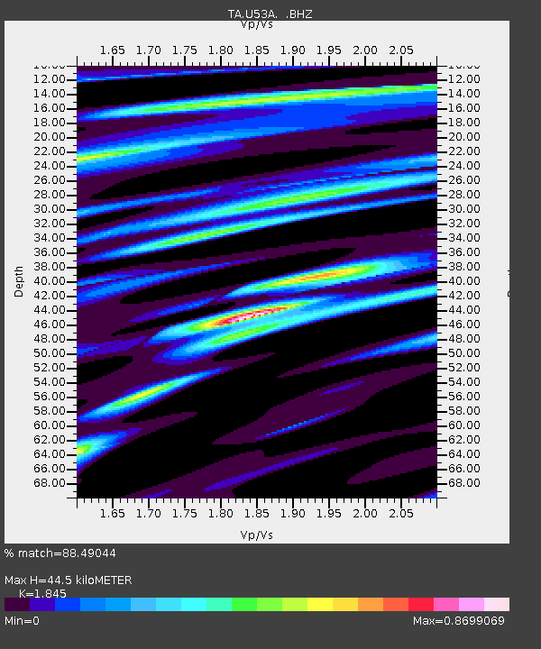
Signal To Noise
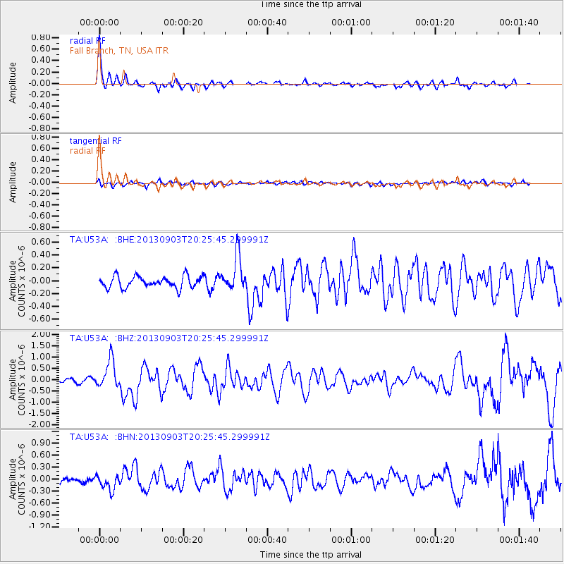
| Channel | StoN | STA | LTA |
| TA:U53A: :BHZ:20130903T20:25:45.299991Z | 8.60547 | 6.3233574E-7 | 7.3480685E-8 |
| TA:U53A: :BHN:20130903T20:25:45.299991Z | 2.4008863 | 1.848264E-7 | 7.698257E-8 |
| TA:U53A: :BHE:20130903T20:25:45.299991Z | 3.1817589 | 2.8457146E-7 | 8.943841E-8 |
| Arrivals | |
| Ps | 6.2 SECOND |
| PpPs | 18 SECOND |
| PsPs/PpSs | 24 SECOND |

