U58A Oxford, NC, USA - Earthquake Result Viewer
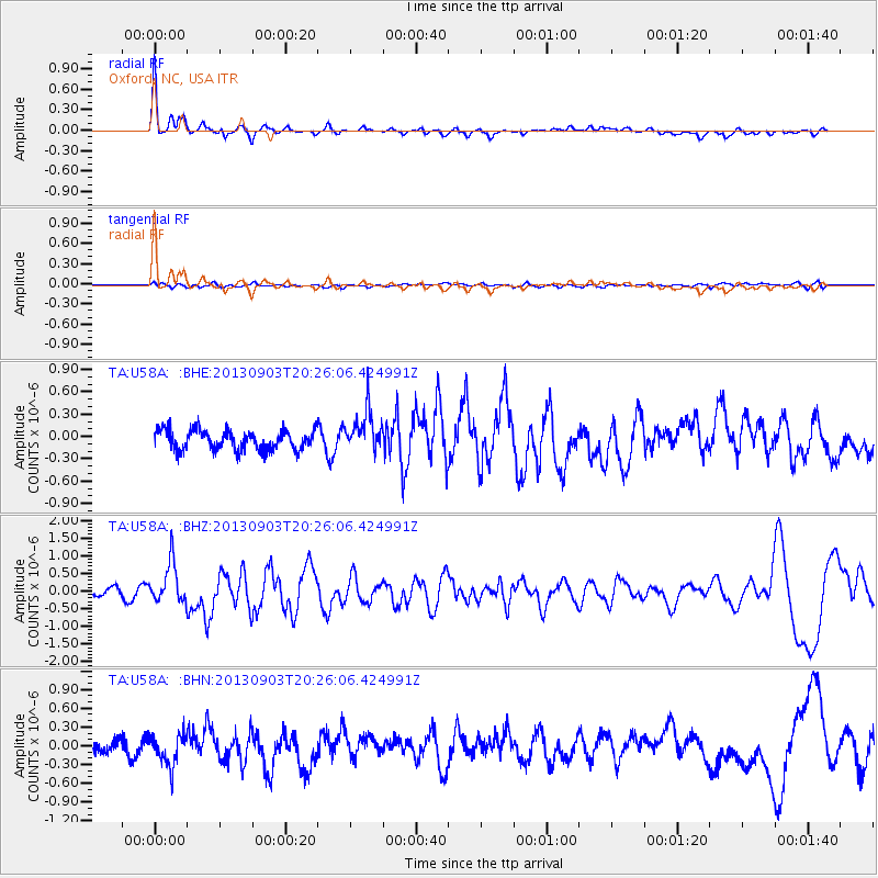
Earthquake location: Queen Charlotte Islands Region
Earthquake latitude/longitude: 51.2/-130.4
Earthquake time(UTC): 2013/09/03 (246) 20:19:06 GMT
Earthquake Depth: 2.7 km
Earthquake Magnitude: 6.1 MWW, 6.0 MWB, 6.1 MWW, 6.1 MWC, 6.2 MI, 6.2 MWC
Earthquake Catalog/Contributor: NEIC PDE/NEIC COMCAT
Network: TA USArray Transportable Network (new EarthScope stations)
Station: U58A Oxford, NC, USA
Lat/Lon: 36.39 N/78.55 W
Elevation: 169 m
Distance: 39.4 deg
Az: 91.475 deg
Baz: 308.852 deg
Ray Param: 0.07502613
Estimated Moho Depth: 17.0 km
Estimated Crust Vp/Vs: 1.89
Assumed Crust Vp: 6.419 km/s
Estimated Crust Vs: 3.392 km/s
Estimated Crust Poisson's Ratio: 0.31
Radial Match: 87.114815 %
Radial Bump: 400
Transverse Match: 38.47026 %
Transverse Bump: 400
SOD ConfigId: 626651
Insert Time: 2014-04-18 08:47:10.806 +0000
GWidth: 2.5
Max Bumps: 400
Tol: 0.001

Signal To Noise

ChannelStoNSTALTA
TA:U58A: :BHZ:20130903T20:26:06.424991Z4.8055555.6806675E-71.18210444E-7
TA:U58A: :BHN:20130903T20:26:06.424991Z2.39078522.4463836E-71.0232553E-7
TA:U58A: :BHE:20130903T20:26:06.424991Z2.09500812.7686502E-71.3215463E-7
Arrivals
Ps2.5 SECOND
PpPs7.2 SECOND
PsPs/PpSs9.7 SECOND