U59A Littleton, NC, USA - Earthquake Result Viewer
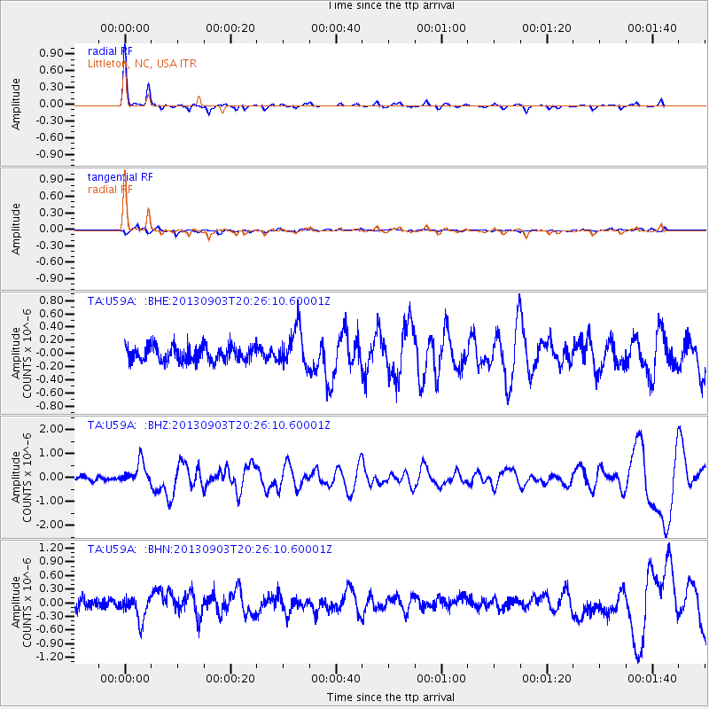
Earthquake location: Queen Charlotte Islands Region
Earthquake latitude/longitude: 51.2/-130.4
Earthquake time(UTC): 2013/09/03 (246) 20:19:06 GMT
Earthquake Depth: 2.7 km
Earthquake Magnitude: 6.1 MWW, 6.0 MWB, 6.1 MWW, 6.1 MWC, 6.2 MI, 6.2 MWC
Earthquake Catalog/Contributor: NEIC PDE/NEIC COMCAT
Network: TA USArray Transportable Network (new EarthScope stations)
Station: U59A Littleton, NC, USA
Lat/Lon: 36.35 N/77.79 W
Elevation: 99 m
Distance: 39.9 deg
Az: 90.925 deg
Baz: 308.875 deg
Ray Param: 0.07473202
Estimated Moho Depth: 26.25 km
Estimated Crust Vp/Vs: 2.08
Assumed Crust Vp: 6.565 km/s
Estimated Crust Vs: 3.152 km/s
Estimated Crust Poisson's Ratio: 0.35
Radial Match: 91.66155 %
Radial Bump: 187
Transverse Match: 60.65607 %
Transverse Bump: 400
SOD ConfigId: 626651
Insert Time: 2014-04-18 08:47:12.653 +0000
GWidth: 2.5
Max Bumps: 400
Tol: 0.001

Signal To Noise

ChannelStoNSTALTA
TA:U59A: :BHZ:20130903T20:26:10.60001Z3.90323384.5533432E-71.1665566E-7
TA:U59A: :BHN:20130903T20:26:10.60001Z2.58068182.6374153E-71.0219839E-7
TA:U59A: :BHE:20130903T20:26:10.60001Z2.4261372.909339E-71.1991652E-7
Arrivals
Ps4.6 SECOND
PpPs12 SECOND
PsPs/PpSs16 SECOND