V50A Pikevile, TN, USA - Earthquake Result Viewer
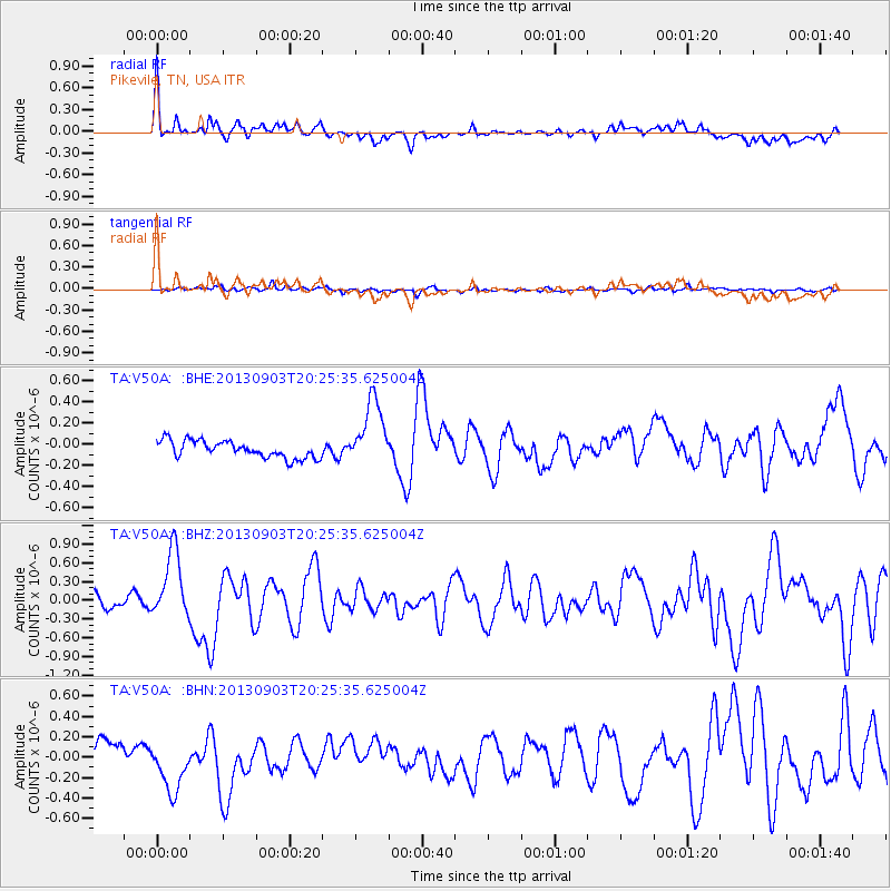
Earthquake location: Queen Charlotte Islands Region
Earthquake latitude/longitude: 51.2/-130.4
Earthquake time(UTC): 2013/09/03 (246) 20:19:06 GMT
Earthquake Depth: 2.7 km
Earthquake Magnitude: 6.1 MWW, 6.0 MWB, 6.1 MWW, 6.1 MWC, 6.2 MI, 6.2 MWC
Earthquake Catalog/Contributor: NEIC PDE/NEIC COMCAT
Network: TA USArray Transportable Network (new EarthScope stations)
Station: V50A Pikevile, TN, USA
Lat/Lon: 35.67 N/85.10 W
Elevation: 287 m
Distance: 35.8 deg
Az: 97.924 deg
Baz: 310.128 deg
Ray Param: 0.07707106
Estimated Moho Depth: 18.25 km
Estimated Crust Vp/Vs: 1.91
Assumed Crust Vp: 6.35 km/s
Estimated Crust Vs: 3.316 km/s
Estimated Crust Poisson's Ratio: 0.31
Radial Match: 82.680885 %
Radial Bump: 400
Transverse Match: 50.292004 %
Transverse Bump: 400
SOD ConfigId: 626651
Insert Time: 2014-04-18 08:47:23.400 +0000
GWidth: 2.5
Max Bumps: 400
Tol: 0.001

Signal To Noise

ChannelStoNSTALTA
TA:V50A: :BHZ:20130903T20:25:35.625004Z4.81871185.4739405E-71.135976E-7
TA:V50A: :BHN:20130903T20:25:35.625004Z1.84852492.5004854E-71.3526922E-7
TA:V50A: :BHE:20130903T20:25:35.625004Z3.9614583.186934E-78.0448515E-8
Arrivals
Ps2.8 SECOND
PpPs7.8 SECOND
PsPs/PpSs11 SECOND