
V52A Sevierville, TN, USA - Earthquake Result Viewer
| ||||||||||||||||||
| ||||||||||||||||||
| ||||||||||||||||||
|
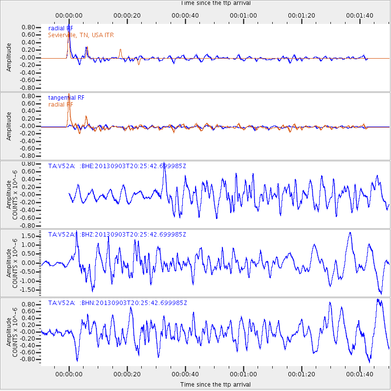
Signal To Noise
| Channel | StoN | STA | LTA |
| TA:V52A: :BHZ:20130903T20:25:42.699985Z | 6.3715653 | 6.143689E-7 | 9.642355E-8 |
| TA:V52A: :BHN:20130903T20:25:42.699985Z | 4.0489974 | 3.3286076E-7 | 8.2208196E-8 |
| TA:V52A: :BHE:20130903T20:25:42.699985Z | 2.5435162 | 3.0844933E-7 | 1.2126887E-7 |
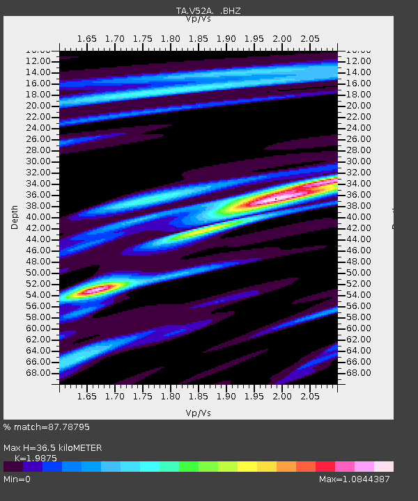
| Arrivals | |
| Ps | 6.1 SECOND |
| PpPs | 16 SECOND |
| PsPs/PpSs | 22 SECOND |

