You are here: Home > Network List > TA - USArray Transportable Network (new EarthScope stations) Stations List
> Station V60A Jim Taylor Road, Stokes, NC, USA > Earthquake Result Viewer
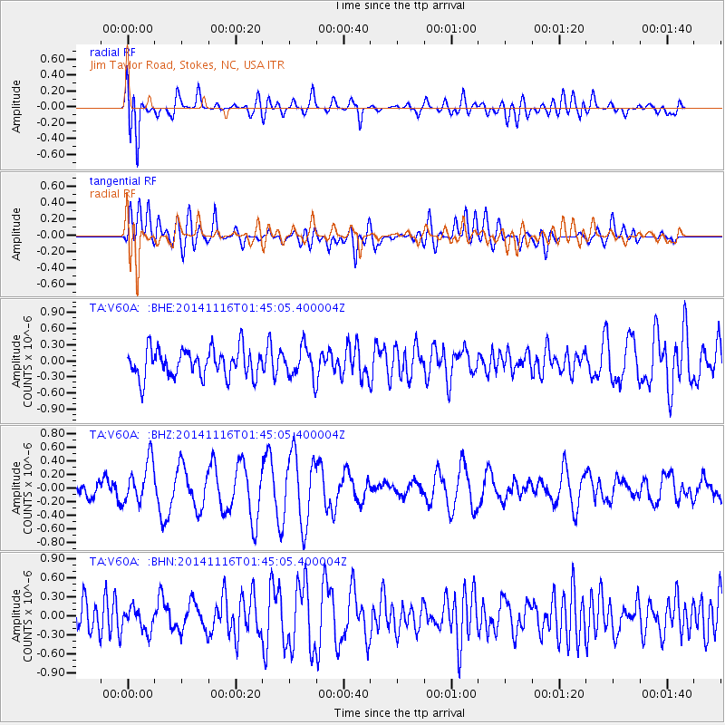
V60A Jim Taylor Road, Stokes, NC, USA - Earthquake Result Viewer
*The percent match for this event was below the threshold and hence no stack was calculated.
| Earthquake location: |
Iceland |
| Earthquake latitude/longitude: |
64.7/-17.6 |
| Earthquake time(UTC): |
2014/11/16 (320) 01:37:17 GMT |
| Earthquake Depth: |
10 km |
| Earthquake Magnitude: |
5.3 MW, 5.0 mb, 5.0 MS |
| Earthquake Catalog/Contributor: |
ISC/ISC |
|
| Network: |
TA USArray Transportable Network (new EarthScope stations) |
| Station: |
V60A Jim Taylor Road, Stokes, NC, USA |
| Lat/Lon: |
35.76 N/77.26 W |
| Elevation: |
8.0 m |
|
| Distance: |
45.4 deg |
| Az: |
260.275 deg |
| Baz: |
31.419 deg |
| Ray Param: |
$rayparam |
*The percent match for this event was below the threshold and hence was not used in the summary stack. |
|
| Radial Match: |
67.82648 % |
| Radial Bump: |
400 |
| Transverse Match: |
53.222206 % |
| Transverse Bump: |
400 |
| SOD ConfigId: |
3390531 |
| Insert Time: |
2019-04-15 00:51:29.708 +0000 |
| GWidth: |
2.5 |
| Max Bumps: |
400 |
| Tol: |
0.001 |
|
Signal To Noise
| Channel | StoN | STA | LTA |
| TA:V60A: :BHZ:20141116T01:45:05.400004Z | 2.3887506 | 3.137303E-7 | 1.3133658E-7 |
| TA:V60A: :BHN:20141116T01:45:05.400004Z | 0.85725504 | 1.842208E-7 | 2.1489613E-7 |
| TA:V60A: :BHE:20141116T01:45:05.400004Z | 1.0993582 | 2.8845366E-7 | 2.6238368E-7 |
| Arrivals |
| Ps | |
| PpPs | |
| PsPs/PpSs | |


