V59A Middlesex, NC, USA - Earthquake Result Viewer
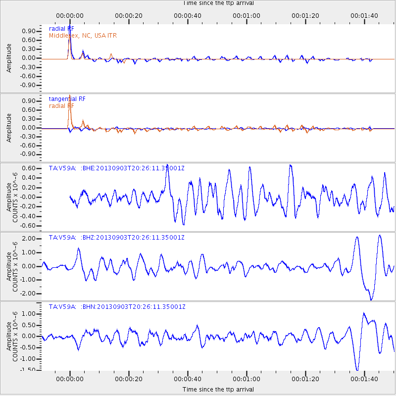
Earthquake location: Queen Charlotte Islands Region
Earthquake latitude/longitude: 51.2/-130.4
Earthquake time(UTC): 2013/09/03 (246) 20:19:06 GMT
Earthquake Depth: 2.7 km
Earthquake Magnitude: 6.1 MWW, 6.0 MWB, 6.1 MWW, 6.1 MWC, 6.2 MI, 6.2 MWC
Earthquake Catalog/Contributor: NEIC PDE/NEIC COMCAT
Network: TA USArray Transportable Network (new EarthScope stations)
Station: V59A Middlesex, NC, USA
Lat/Lon: 35.76 N/78.24 W
Elevation: 58 m
Distance: 40.0 deg
Az: 91.99 deg
Baz: 309.429 deg
Ray Param: 0.07467693
Estimated Moho Depth: 27.75 km
Estimated Crust Vp/Vs: 2.03
Assumed Crust Vp: 6.565 km/s
Estimated Crust Vs: 3.234 km/s
Estimated Crust Poisson's Ratio: 0.34
Radial Match: 92.251045 %
Radial Bump: 291
Transverse Match: 61.402203 %
Transverse Bump: 400
SOD ConfigId: 626651
Insert Time: 2014-04-18 08:47:42.550 +0000
GWidth: 2.5
Max Bumps: 400
Tol: 0.001

Signal To Noise

ChannelStoNSTALTA
TA:V59A: :BHZ:20130903T20:26:11.35001Z4.9561565.912785E-71.1930183E-7
TA:V59A: :BHN:20130903T20:26:11.35001Z2.87270572.256208E-77.853948E-8
TA:V59A: :BHE:20130903T20:26:11.35001Z3.12302352.8676766E-79.182373E-8
Arrivals
Ps4.6 SECOND
PpPs12 SECOND
PsPs/PpSs17 SECOND