W39A Magazine, AR, USA - Earthquake Result Viewer
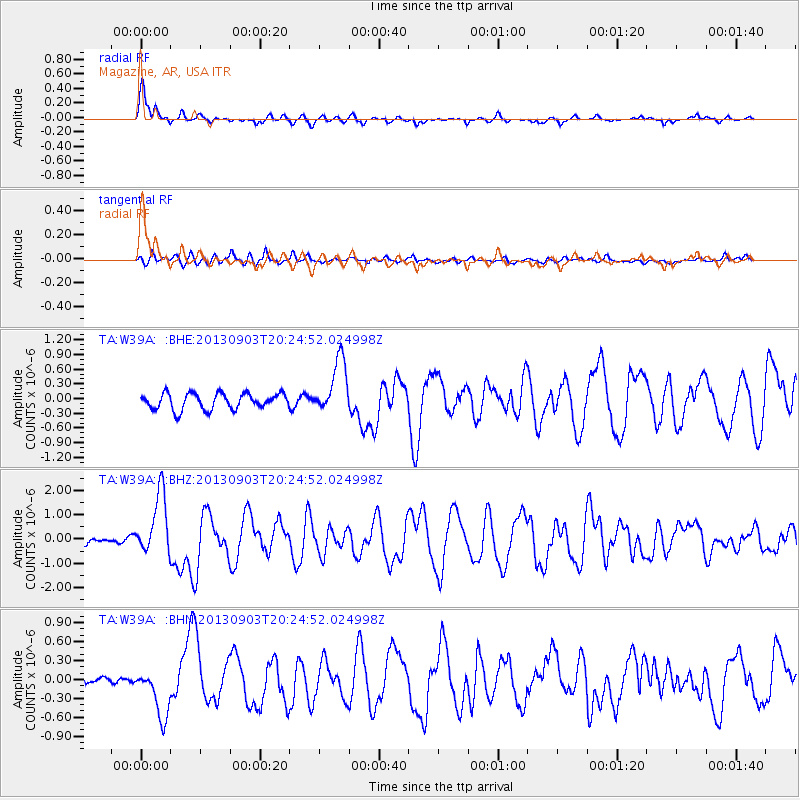
Earthquake location: Queen Charlotte Islands Region
Earthquake latitude/longitude: 51.2/-130.4
Earthquake time(UTC): 2013/09/03 (246) 20:19:06 GMT
Earthquake Depth: 2.7 km
Earthquake Magnitude: 6.1 MWW, 6.0 MWB, 6.1 MWW, 6.1 MWC, 6.2 MI, 6.2 MWC
Earthquake Catalog/Contributor: NEIC PDE/NEIC COMCAT
Network: TA USArray Transportable Network (new EarthScope stations)
Station: W39A Magazine, AR, USA
Lat/Lon: 35.20 N/93.78 W
Elevation: 162 m
Distance: 30.7 deg
Az: 107.139 deg
Baz: 312.829 deg
Ray Param: 0.079261385
Estimated Moho Depth: 56.0 km
Estimated Crust Vp/Vs: 1.75
Assumed Crust Vp: 6.498 km/s
Estimated Crust Vs: 3.718 km/s
Estimated Crust Poisson's Ratio: 0.26
Radial Match: 89.67606 %
Radial Bump: 379
Transverse Match: 59.055176 %
Transverse Bump: 400
SOD ConfigId: 626651
Insert Time: 2014-04-18 08:47:50.148 +0000
GWidth: 2.5
Max Bumps: 400
Tol: 0.001

Signal To Noise

ChannelStoNSTALTA
TA:W39A: :BHZ:20130903T20:24:52.024998Z9.6318541.2611016E-61.309303E-7
TA:W39A: :BHN:20130903T20:24:52.024998Z3.4387074.0277644E-71.171302E-7
TA:W39A: :BHE:20130903T20:24:52.024998Z3.47493555.637277E-71.6222681E-7
Arrivals
Ps7.0 SECOND
PpPs22 SECOND
PsPs/PpSs29 SECOND