W56A Indian Trail, NC, USA - Earthquake Result Viewer
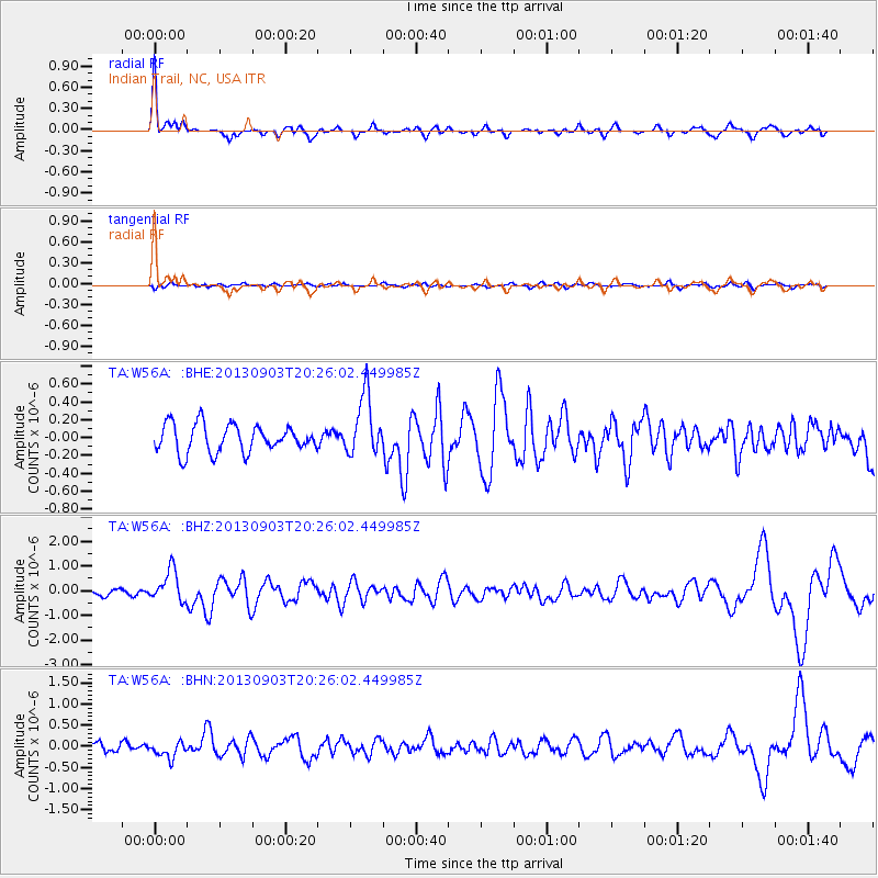
Earthquake location: Queen Charlotte Islands Region
Earthquake latitude/longitude: 51.2/-130.4
Earthquake time(UTC): 2013/09/03 (246) 20:19:06 GMT
Earthquake Depth: 2.7 km
Earthquake Magnitude: 6.1 MWW, 6.0 MWB, 6.1 MWW, 6.1 MWC, 6.2 MI, 6.2 MWC
Earthquake Catalog/Contributor: NEIC PDE/NEIC COMCAT
Network: TA USArray Transportable Network (new EarthScope stations)
Station: W56A Indian Trail, NC, USA
Lat/Lon: 35.13 N/80.58 W
Elevation: 177 m
Distance: 38.9 deg
Az: 94.676 deg
Baz: 310.151 deg
Ray Param: 0.075301714
Estimated Moho Depth: 38.75 km
Estimated Crust Vp/Vs: 1.65
Assumed Crust Vp: 6.419 km/s
Estimated Crust Vs: 3.879 km/s
Estimated Crust Poisson's Ratio: 0.21
Radial Match: 89.0376 %
Radial Bump: 400
Transverse Match: 44.860928 %
Transverse Bump: 400
SOD ConfigId: 626651
Insert Time: 2014-04-18 08:48:07.472 +0000
GWidth: 2.5
Max Bumps: 400
Tol: 0.001

Signal To Noise

ChannelStoNSTALTA
TA:W56A: :BHZ:20130903T20:26:02.449985Z3.72197586.372401E-71.7121016E-7
TA:W56A: :BHN:20130903T20:26:02.449985Z1.35309091.8544154E-71.370503E-7
TA:W56A: :BHE:20130903T20:26:02.449985Z2.2047593.3924061E-71.5386743E-7
Arrivals
Ps4.3 SECOND
PpPs15 SECOND
PsPs/PpSs19 SECOND