W58A Raeford, NC, USA - Earthquake Result Viewer
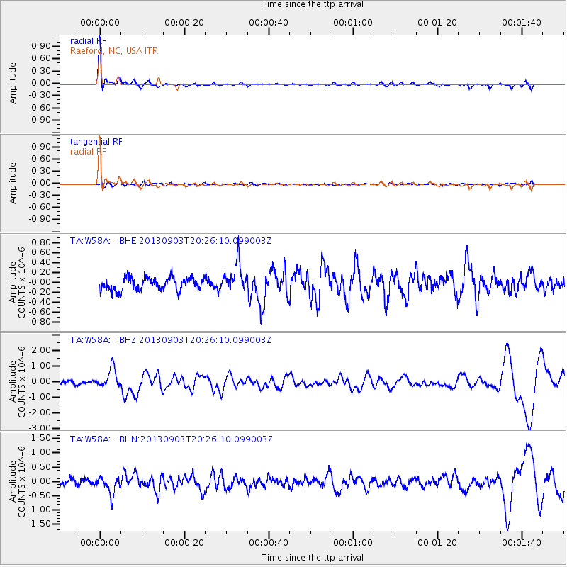
Earthquake location: Queen Charlotte Islands Region
Earthquake latitude/longitude: 51.2/-130.4
Earthquake time(UTC): 2013/09/03 (246) 20:19:06 GMT
Earthquake Depth: 2.7 km
Earthquake Magnitude: 6.1 MWW, 6.0 MWB, 6.1 MWW, 6.1 MWC, 6.2 MI, 6.2 MWC
Earthquake Catalog/Contributor: NEIC PDE/NEIC COMCAT
Network: TA USArray Transportable Network (new EarthScope stations)
Station: W58A Raeford, NC, USA
Lat/Lon: 35.02 N/79.23 W
Elevation: 84 m
Distance: 39.8 deg
Az: 93.689 deg
Baz: 310.16 deg
Ray Param: 0.07476837
Estimated Moho Depth: 41.5 km
Estimated Crust Vp/Vs: 1.70
Assumed Crust Vp: 6.565 km/s
Estimated Crust Vs: 3.873 km/s
Estimated Crust Poisson's Ratio: 0.23
Radial Match: 90.16116 %
Radial Bump: 400
Transverse Match: 42.145508 %
Transverse Bump: 400
SOD ConfigId: 626651
Insert Time: 2014-04-18 08:48:12.389 +0000
GWidth: 2.5
Max Bumps: 400
Tol: 0.001

Signal To Noise

ChannelStoNSTALTA
TA:W58A: :BHZ:20130903T20:26:10.099003Z4.96816976.3742544E-71.2830186E-7
TA:W58A: :BHN:20130903T20:26:10.099003Z3.60472353.064548E-78.501479E-8
TA:W58A: :BHE:20130903T20:26:10.099003Z2.39289572.985784E-71.2477703E-7
Arrivals
Ps4.7 SECOND
PpPs16 SECOND
PsPs/PpSs21 SECOND