X58A Rowland, NC, USA - Earthquake Result Viewer
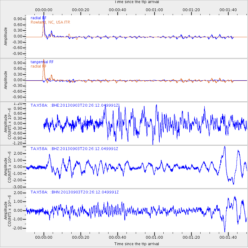
Earthquake location: Queen Charlotte Islands Region
Earthquake latitude/longitude: 51.2/-130.4
Earthquake time(UTC): 2013/09/03 (246) 20:19:06 GMT
Earthquake Depth: 2.7 km
Earthquake Magnitude: 6.1 MWW, 6.0 MWB, 6.1 MWW, 6.1 MWC, 6.2 MI, 6.2 MWC
Earthquake Catalog/Contributor: NEIC PDE/NEIC COMCAT
Network: TA USArray Transportable Network (new EarthScope stations)
Station: X58A Rowland, NC, USA
Lat/Lon: 34.55 N/79.34 W
Elevation: 45 m
Distance: 40.1 deg
Az: 94.328 deg
Baz: 310.59 deg
Ray Param: 0.07462358
Estimated Moho Depth: 32.0 km
Estimated Crust Vp/Vs: 1.82
Assumed Crust Vp: 6.565 km/s
Estimated Crust Vs: 3.602 km/s
Estimated Crust Poisson's Ratio: 0.28
Radial Match: 89.49567 %
Radial Bump: 331
Transverse Match: 53.639793 %
Transverse Bump: 400
SOD ConfigId: 626651
Insert Time: 2014-04-18 08:48:40.713 +0000
GWidth: 2.5
Max Bumps: 400
Tol: 0.001

Signal To Noise

ChannelStoNSTALTA
TA:X58A: :BHZ:20130903T20:26:12.049991Z4.4954177.2230796E-71.6067652E-7
TA:X58A: :BHN:20130903T20:26:12.049991Z1.72190713.1894376E-71.8522705E-7
TA:X58A: :BHE:20130903T20:26:12.049991Z2.16467714.5345433E-72.0947896E-7
Arrivals
Ps4.3 SECOND
PpPs13 SECOND
PsPs/PpSs17 SECOND