X59A McDuffie Farm, Elizabethtown, NC, USA - Earthquake Result Viewer
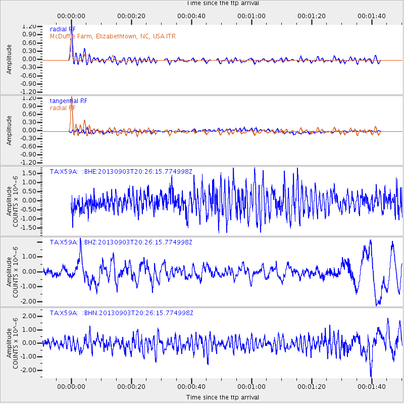
Earthquake location: Queen Charlotte Islands Region
Earthquake latitude/longitude: 51.2/-130.4
Earthquake time(UTC): 2013/09/03 (246) 20:19:06 GMT
Earthquake Depth: 2.7 km
Earthquake Magnitude: 6.1 MWW, 6.0 MWB, 6.1 MWW, 6.1 MWC, 6.2 MI, 6.2 MWC
Earthquake Catalog/Contributor: NEIC PDE/NEIC COMCAT
Network: TA USArray Transportable Network (new EarthScope stations)
Station: X59A McDuffie Farm, Elizabethtown, NC, USA
Lat/Lon: 34.57 N/78.60 W
Elevation: 29 m
Distance: 40.5 deg
Az: 93.697 deg
Baz: 310.524 deg
Ray Param: 0.07436953
Estimated Moho Depth: 29.25 km
Estimated Crust Vp/Vs: 1.93
Assumed Crust Vp: 6.565 km/s
Estimated Crust Vs: 3.393 km/s
Estimated Crust Poisson's Ratio: 0.32
Radial Match: 80.50852 %
Radial Bump: 400
Transverse Match: 45.416378 %
Transverse Bump: 400
SOD ConfigId: 626651
Insert Time: 2014-04-18 08:48:42.305 +0000
GWidth: 2.5
Max Bumps: 400
Tol: 0.001

Signal To Noise

ChannelStoNSTALTA
TA:X59A: :BHZ:20130903T20:26:15.774998Z5.81568577.356567E-71.2649527E-7
TA:X59A: :BHN:20130903T20:26:15.774998Z1.46795234.1314863E-72.8144555E-7
TA:X59A: :BHE:20130903T20:26:15.774998Z1.39237435.2770787E-73.789986E-7
Arrivals
Ps4.5 SECOND
PpPs12 SECOND
PsPs/PpSs17 SECOND