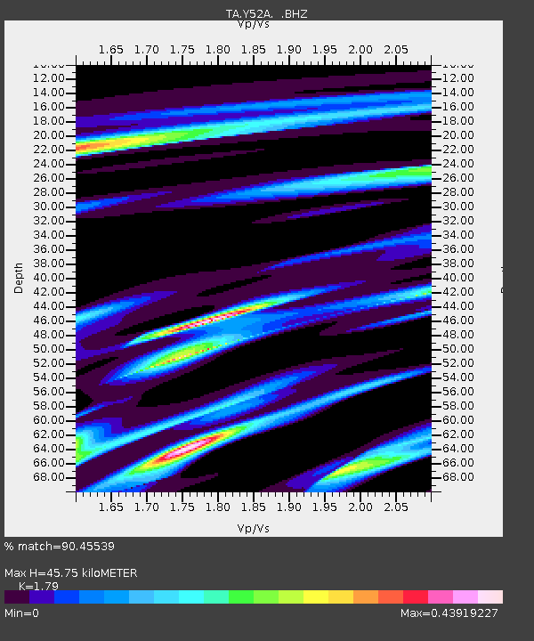
Y52A Lilburn, GA, USA - Earthquake Result Viewer
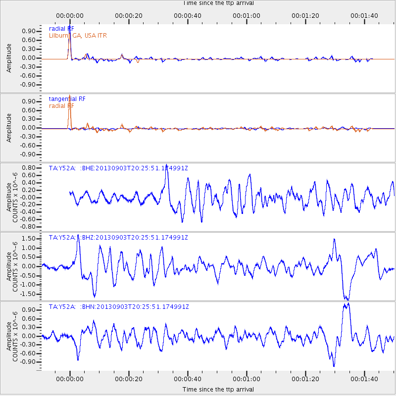
Earthquake location: Queen Charlotte Islands Region
Earthquake latitude/longitude: 51.2/-130.4
Earthquake time(UTC): 2013/09/03 (246) 20:19:06 GMT
Earthquake Depth: 2.7 km
Earthquake Magnitude: 6.1 MWW, 6.0 MWB, 6.1 MWW, 6.1 MWC, 6.2 MI, 6.2 MWC
Earthquake Catalog/Contributor: NEIC PDE/NEIC COMCAT
Network: TA USArray Transportable Network (new EarthScope stations)
Station: Y52A Lilburn, GA, USA
Lat/Lon: 33.86 N/84.06 W
Elevation: 286 m
Distance: 37.6 deg
Az: 99.266 deg
Baz: 311.794 deg
Ray Param: 0.07607581
Estimated Moho Depth: 45.75 km
Estimated Crust Vp/Vs: 1.79
Assumed Crust Vp: 6.719 km/s
Estimated Crust Vs: 3.754 km/s
Estimated Crust Poisson's Ratio: 0.27
Radial Match: 90.45539 %
Radial Bump: 260
Transverse Match: 55.360287 %
Transverse Bump: 400
SOD ConfigId: 626651
Insert Time: 2014-04-18 08:48:51.508 +0000
GWidth: 2.5
Max Bumps: 400
Tol: 0.001

Signal To Noise

ChannelStoNSTALTA
TA:Y52A: :BHZ:20130903T20:25:51.174991Z6.30219277.112199E-71.12852774E-7
TA:Y52A: :BHN:20130903T20:25:51.174991Z5.32265953.2228516E-76.054965E-8
TA:Y52A: :BHE:20130903T20:25:51.174991Z3.63905143.7327658E-71.0257524E-7
Arrivals
Ps5.8 SECOND
PpPs18 SECOND
PsPs/PpSs23 SECOND