Y54A Tignall, GA, USA - Earthquake Result Viewer
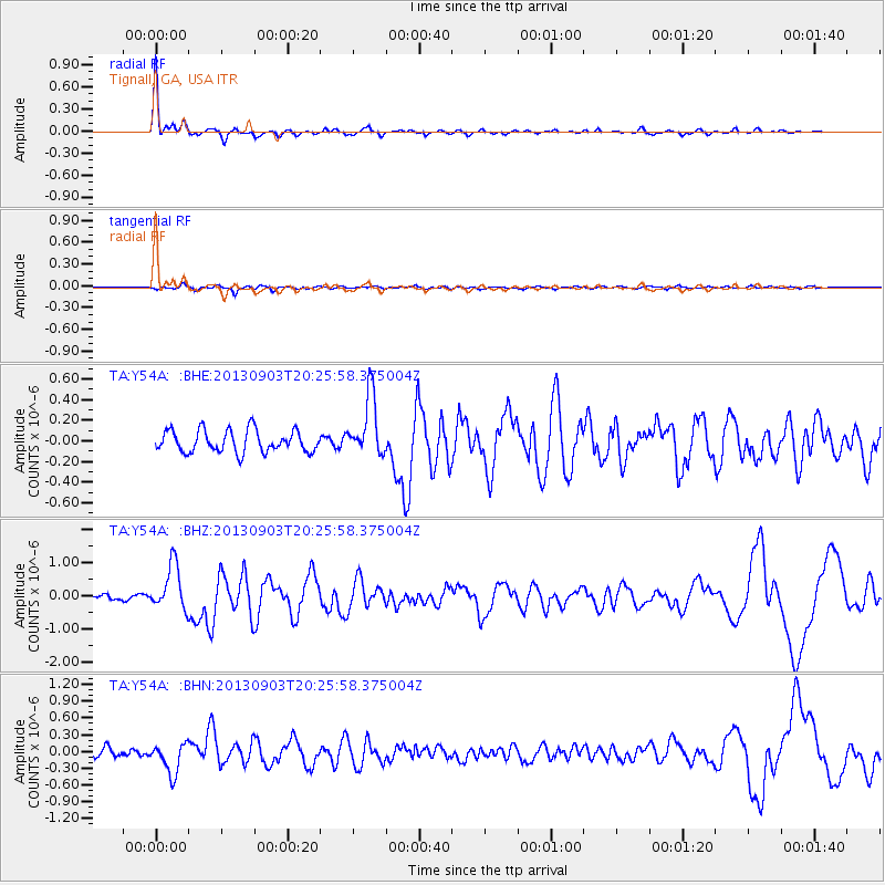
Earthquake location: Queen Charlotte Islands Region
Earthquake latitude/longitude: 51.2/-130.4
Earthquake time(UTC): 2013/09/03 (246) 20:19:06 GMT
Earthquake Depth: 2.7 km
Earthquake Magnitude: 6.1 MWW, 6.0 MWB, 6.1 MWW, 6.1 MWC, 6.2 MI, 6.2 MWC
Earthquake Catalog/Contributor: NEIC PDE/NEIC COMCAT
Network: TA USArray Transportable Network (new EarthScope stations)
Station: Y54A Tignall, GA, USA
Lat/Lon: 33.86 N/82.69 W
Elevation: 176 m
Distance: 38.4 deg
Az: 98.033 deg
Baz: 311.585 deg
Ray Param: 0.07558152
Estimated Moho Depth: 20.25 km
Estimated Crust Vp/Vs: 1.78
Assumed Crust Vp: 6.565 km/s
Estimated Crust Vs: 3.688 km/s
Estimated Crust Poisson's Ratio: 0.27
Radial Match: 92.96884 %
Radial Bump: 273
Transverse Match: 58.45695 %
Transverse Bump: 400
SOD ConfigId: 626651
Insert Time: 2014-04-18 08:48:55.839 +0000
GWidth: 2.5
Max Bumps: 400
Tol: 0.001

Signal To Noise

ChannelStoNSTALTA
TA:Y54A: :BHZ:20130903T20:25:58.375004Z8.7987756.8788836E-77.818002E-8
TA:Y54A: :BHN:20130903T20:25:58.375004Z4.19875762.7356074E-76.515278E-8
TA:Y54A: :BHE:20130903T20:25:58.375004Z2.77696752.9425982E-71.0596444E-7
Arrivals
Ps2.6 SECOND
PpPs8.0 SECOND
PsPs/PpSs11 SECOND