
Z41A Richland Creek Farm, El Dorado, AR, USA - Earthquake Result Viewer
| ||||||||||||||||||
| ||||||||||||||||||
| ||||||||||||||||||
|
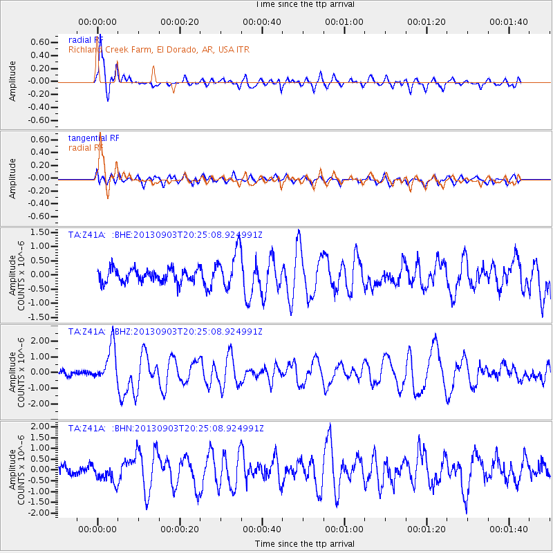
Signal To Noise
| Channel | StoN | STA | LTA |
| TA:Z41A: :BHZ:20130903T20:25:08.924991Z | 6.153747 | 1.2096885E-6 | 1.9657756E-7 |
| TA:Z41A: :BHN:20130903T20:25:08.924991Z | 2.0244448 | 4.4663696E-7 | 2.2062193E-7 |
| TA:Z41A: :BHE:20130903T20:25:08.924991Z | 2.983596 | 6.887237E-7 | 2.3083676E-7 |
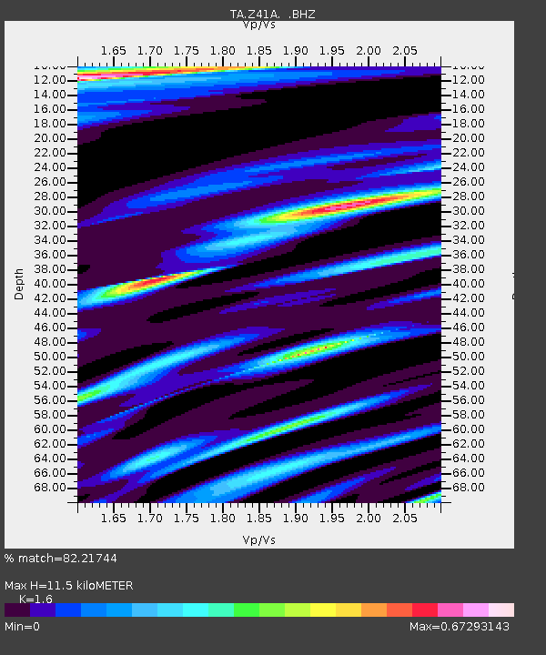
| Arrivals | |
| Ps | 1.2 SECOND |
| PpPs | 4.4 SECOND |
| PsPs/PpSs | 5.6 SECOND |

