You are here: Home > Network List > US - United States National Seismic Network Stations List
> Station DUG Dugway, Tooele County, Utah, USA > Earthquake Result Viewer
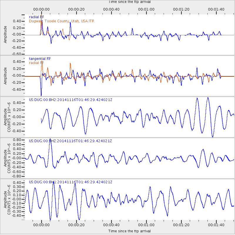
DUG Dugway, Tooele County, Utah, USA - Earthquake Result Viewer
*The percent match for this event was below the threshold and hence no stack was calculated.
| Earthquake location: |
Iceland |
| Earthquake latitude/longitude: |
64.7/-17.6 |
| Earthquake time(UTC): |
2014/11/16 (320) 01:37:17 GMT |
| Earthquake Depth: |
10 km |
| Earthquake Magnitude: |
5.3 MW, 5.0 mb, 5.0 MS |
| Earthquake Catalog/Contributor: |
ISC/ISC |
|
| Network: |
US United States National Seismic Network |
| Station: |
DUG Dugway, Tooele County, Utah, USA |
| Lat/Lon: |
40.19 N/112.81 W |
| Elevation: |
1477 m |
|
| Distance: |
56.6 deg |
| Az: |
293.999 deg |
| Baz: |
30.864 deg |
| Ray Param: |
$rayparam |
*The percent match for this event was below the threshold and hence was not used in the summary stack. |
|
| Radial Match: |
62.496414 % |
| Radial Bump: |
313 |
| Transverse Match: |
54.990944 % |
| Transverse Bump: |
346 |
| SOD ConfigId: |
3390531 |
| Insert Time: |
2019-04-15 00:52:10.660 +0000 |
| GWidth: |
2.5 |
| Max Bumps: |
400 |
| Tol: |
0.001 |
|
Signal To Noise
| Channel | StoN | STA | LTA |
| US:DUG:00:BHZ:20141116T01:46:29.424021Z | 2.9739838 | 2.8963896E-7 | 9.73909E-8 |
| US:DUG:00:BH1:20141116T01:46:29.424021Z | 0.9713134 | 1.763201E-7 | 1.815275E-7 |
| US:DUG:00:BH2:20141116T01:46:29.424021Z | 0.70636404 | 1.2709828E-7 | 1.7993311E-7 |
| Arrivals |
| Ps | |
| PpPs | |
| PsPs/PpSs | |


