LRAL Lakeview Retreat, Alabama, USA - Earthquake Result Viewer
Earthquake location: Queen Charlotte Islands Region
Earthquake latitude/longitude: 51.2/-130.4
Earthquake time(UTC): 2013/09/03 (246) 20:19:06 GMT
Earthquake Depth: 2.7 km
Earthquake Magnitude: 6.1 MWW, 6.0 MWB, 6.1 MWW, 6.1 MWC, 6.2 MI, 6.2 MWC
Earthquake Catalog/Contributor: NEIC PDE/NEIC COMCAT
Network: US United States National Seismic Network
Station: LRAL Lakeview Retreat, Alabama, USA
Lat/Lon: 33.03 N/87.00 W
Elevation: 130 m
Distance: 36.3 deg
Az: 103.038 deg
Baz: 313.198 deg
Ray Param: 0.07675773
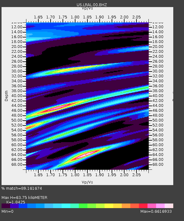
Estimated Moho Depth: 63.75 km
Estimated Crust Vp/Vs: 1.84
Assumed Crust Vp: 6.565 km/s
Estimated Crust Vs: 3.563 km/s
Estimated Crust Poisson's Ratio: 0.29
Radial Match: 89.161674 %
Radial Bump: 358
Transverse Match: 64.56244 %
Transverse Bump: 379
SOD ConfigId: 626651
Insert Time: 2014-04-18 08:50:13.895 +0000
GWidth: 2.5
Max Bumps: 400
Tol: 0.001

Signal To Noise

ChannelStoNSTALTA
US:LRAL:00:BHZ:20130903T20:25:40.549991Z5.40931037.117772E-71.3158372E-7
US:LRAL:00:BH1:20130903T20:25:40.549991Z2.5573132.9496178E-71.15340505E-7
US:LRAL:00:BH2:20130903T20:25:40.549991Z2.30024363.1120516E-71.3529225E-7
Arrivals
Ps8.8 SECOND
PpPs26 SECOND
PsPs/PpSs34 SECOND