You are here: Home > Network List > UW - Pacific Northwest Regional Seismic Network Stations List
> Station MRBL Marblemount, WA, USA > Earthquake Result Viewer
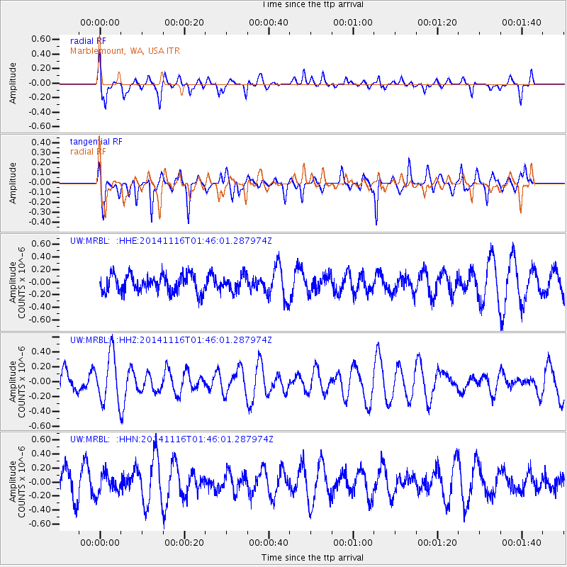
MRBL Marblemount, WA, USA - Earthquake Result Viewer
*The percent match for this event was below the threshold and hence no stack was calculated.
| Earthquake location: |
Iceland |
| Earthquake latitude/longitude: |
64.7/-17.6 |
| Earthquake time(UTC): |
2014/11/16 (320) 01:37:17 GMT |
| Earthquake Depth: |
10 km |
| Earthquake Magnitude: |
5.3 MW, 5.0 mb, 5.0 MS |
| Earthquake Catalog/Contributor: |
ISC/ISC |
|
| Network: |
UW Pacific Northwest Regional Seismic Network |
| Station: |
MRBL Marblemount, WA, USA |
| Lat/Lon: |
48.52 N/121.48 W |
| Elevation: |
75 m |
|
| Distance: |
52.7 deg |
| Az: |
305.804 deg |
| Baz: |
31.647 deg |
| Ray Param: |
$rayparam |
*The percent match for this event was below the threshold and hence was not used in the summary stack. |
|
| Radial Match: |
48.422737 % |
| Radial Bump: |
400 |
| Transverse Match: |
62.76284 % |
| Transverse Bump: |
400 |
| SOD ConfigId: |
3390531 |
| Insert Time: |
2019-04-15 00:52:38.429 +0000 |
| GWidth: |
2.5 |
| Max Bumps: |
400 |
| Tol: |
0.001 |
|
Signal To Noise
| Channel | StoN | STA | LTA |
| UW:MRBL: :HHZ:20141116T01:46:01.287974Z | 2.2854748 | 3.286915E-7 | 1.438176E-7 |
| UW:MRBL: :HHN:20141116T01:46:01.287974Z | 0.69622487 | 1.3656734E-7 | 1.9615406E-7 |
| UW:MRBL: :HHE:20141116T01:46:01.287974Z | 0.87898 | 1.233086E-7 | 1.4028602E-7 |
| Arrivals |
| Ps | |
| PpPs | |
| PsPs/PpSs | |


