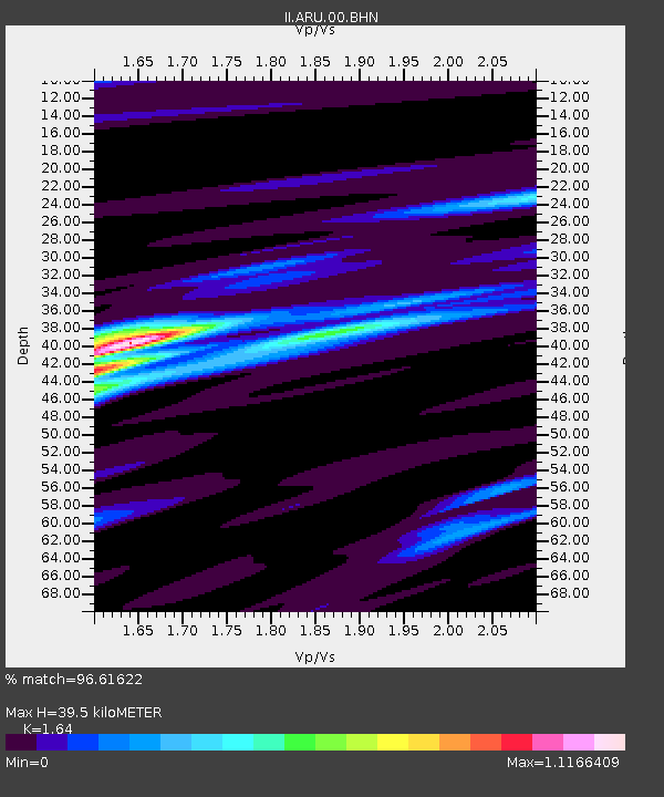
ARU Arti, Russia - Earthquake Result Viewer
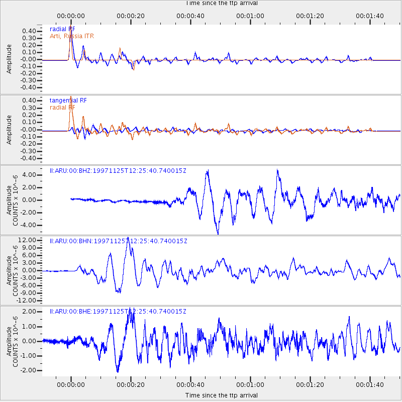
Earthquake location: Minahassa Peninsula, Sulawesi
Earthquake latitude/longitude: 1.2/122.5
Earthquake time(UTC): 1997/11/25 (329) 12:14:33 GMT
Earthquake Depth: 24 km
Earthquake Magnitude: 6.1 MB, 6.8 MS, 7.1 UNKNOWN, 6.7 ME
Earthquake Catalog/Contributor: WHDF/NEIC
Network: II Global Seismograph Network (GSN - IRIS/IDA)
Station: ARU Arti, Russia
Lat/Lon: 56.43 N/58.56 E
Elevation: 250 m
Distance: 74.8 deg
Az: 328.855 deg
Baz: 111.441 deg
Ray Param: 0.052038275
Estimated Moho Depth: 39.5 km
Estimated Crust Vp/Vs: 1.64
Assumed Crust Vp: 6.159 km/s
Estimated Crust Vs: 3.755 km/s
Estimated Crust Poisson's Ratio: 0.20
Radial Match: 96.61622 %
Radial Bump: 331
Transverse Match: 86.33771 %
Transverse Bump: 400
SOD ConfigId: 4480
Insert Time: 2010-03-01 16:29:19.939 +0000
GWidth: 2.5
Max Bumps: 400
Tol: 0.001

Signal To Noise

ChannelStoNSTALTA
II:ARU:00:BHN:19971125T12:25:40.740015Z8.0855518.466292E-71.04708896E-7
II:ARU:00:BHE:19971125T12:25:40.740015Z1.9646832.0269883E-71.0317127E-7
II:ARU:00:BHZ:19971125T12:25:40.740015Z2.68422254.4034618E-71.6404981E-7
Arrivals
Ps4.2 SECOND
PpPs16 SECOND
PsPs/PpSs21 SECOND