ARU Arti, Russia - Earthquake Result Viewer
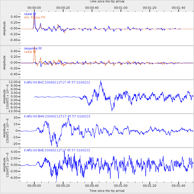
Earthquake location: Talaud Islands, Indonesia
Earthquake latitude/longitude: 3.9/126.4
Earthquake time(UTC): 2009/02/11 (042) 17:34:50 GMT
Earthquake Depth: 22 km
Earthquake Magnitude: 6.6 MB, 7.2 MS, 7.2 MW, 7.1 MW
Earthquake Catalog/Contributor: WHDF/NEIC
Network: II Global Seismograph Network (GSN - IRIS/IDA)
Station: ARU Arti, Russia
Lat/Lon: 56.43 N/58.56 E
Elevation: 250 m
Distance: 74.6 deg
Az: 327.754 deg
Baz: 106.609 deg
Ray Param: 0.05218129
Estimated Moho Depth: 41.0 km
Estimated Crust Vp/Vs: 1.64
Assumed Crust Vp: 6.159 km/s
Estimated Crust Vs: 3.755 km/s
Estimated Crust Poisson's Ratio: 0.20
Radial Match: 97.64436 %
Radial Bump: 319
Transverse Match: 88.12927 %
Transverse Bump: 400
SOD ConfigId: 2658
Insert Time: 2010-03-01 16:30:25.205 +0000
GWidth: 2.5
Max Bumps: 400
Tol: 0.001

Signal To Noise

ChannelStoNSTALTA
II:ARU:00:BHN:20090211T17:45:57.010022Z12.8974922.4130075E-61.8709122E-7
II:ARU:00:BHE:20090211T17:45:57.010022Z4.53429275.020961E-71.10733055E-7
II:ARU:00:BHZ:20090211T17:45:57.010022Z6.25834668.8028264E-71.4065738E-7
Arrivals
Ps4.4 SECOND
PpPs17 SECOND
PsPs/PpSs21 SECOND