You are here: Home > Network List > TA - USArray Transportable Network (new EarthScope stations) Stations List
> Station 109C Camp Elliot, Mirimar, CA, USA > Earthquake Result Viewer
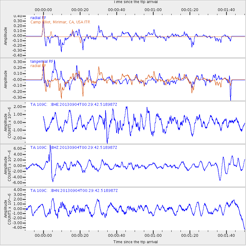
109C Camp Elliot, Mirimar, CA, USA - Earthquake Result Viewer
*The percent match for this event was below the threshold and hence no stack was calculated.
| Earthquake location: |
Southeast Of Honshu, Japan |
| Earthquake latitude/longitude: |
29.9/138.8 |
| Earthquake time(UTC): |
2013/09/04 (247) 00:18:23 GMT |
| Earthquake Depth: |
402 km |
| Earthquake Magnitude: |
6.5 MWW, 6.5 MWW, 6.5 MWB, 6.5 MWC |
| Earthquake Catalog/Contributor: |
NEIC PDE/NEIC COMCAT |
|
| Network: |
TA USArray Transportable Network (new EarthScope stations) |
| Station: |
109C Camp Elliot, Mirimar, CA, USA |
| Lat/Lon: |
32.89 N/117.11 W |
| Elevation: |
150 m |
|
| Distance: |
84.8 deg |
| Az: |
55.041 deg |
| Baz: |
302.275 deg |
| Ray Param: |
$rayparam |
*The percent match for this event was below the threshold and hence was not used in the summary stack. |
|
| Radial Match: |
55.78307 % |
| Radial Bump: |
342 |
| Transverse Match: |
52.215664 % |
| Transverse Bump: |
303 |
| SOD ConfigId: |
626651 |
| Insert Time: |
2014-04-18 09:23:58.721 +0000 |
| GWidth: |
2.5 |
| Max Bumps: |
400 |
| Tol: |
0.001 |
|
Signal To Noise
| Channel | StoN | STA | LTA |
| TA:109C: :BHZ:20130904T00:29:42.518987Z | 3.2305431 | 2.8303639E-6 | 8.7612636E-7 |
| TA:109C: :BHN:20130904T00:29:42.518987Z | 1.3945869 | 1.053992E-6 | 7.557736E-7 |
| TA:109C: :BHE:20130904T00:29:42.518987Z | 1.1046029 | 7.76571E-7 | 7.0303184E-7 |
| Arrivals |
| Ps | |
| PpPs | |
| PsPs/PpSs | |


