You are here: Home > Network List > TA - USArray Transportable Network (new EarthScope stations) Stations List
> Station A36M Sachs Harbour, NT, CAN > Earthquake Result Viewer
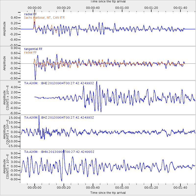
A36M Sachs Harbour, NT, CAN - Earthquake Result Viewer
*The percent match for this event was below the threshold and hence no stack was calculated.
| Earthquake location: |
Southeast Of Honshu, Japan |
| Earthquake latitude/longitude: |
29.9/138.8 |
| Earthquake time(UTC): |
2013/09/04 (247) 00:18:23 GMT |
| Earthquake Depth: |
402 km |
| Earthquake Magnitude: |
6.5 MWW, 6.5 MWW, 6.5 MWB, 6.5 MWC |
| Earthquake Catalog/Contributor: |
NEIC PDE/NEIC COMCAT |
|
| Network: |
TA USArray Transportable Network (new EarthScope stations) |
| Station: |
A36M Sachs Harbour, NT, CAN |
| Lat/Lon: |
71.99 N/125.25 W |
| Elevation: |
32 m |
|
| Distance: |
63.6 deg |
| Az: |
20.205 deg |
| Baz: |
285.508 deg |
| Ray Param: |
$rayparam |
*The percent match for this event was below the threshold and hence was not used in the summary stack. |
|
| Radial Match: |
54.29905 % |
| Radial Bump: |
400 |
| Transverse Match: |
70.1079 % |
| Transverse Bump: |
382 |
| SOD ConfigId: |
626651 |
| Insert Time: |
2014-04-18 09:24:02.758 +0000 |
| GWidth: |
2.5 |
| Max Bumps: |
400 |
| Tol: |
0.001 |
|
Signal To Noise
| Channel | StoN | STA | LTA |
| TA:A36M: :BHZ:20130904T00:27:42.424993Z | 4.294569 | 4.7338485E-6 | 1.1022872E-6 |
| TA:A36M: :BHN:20130904T00:27:42.424993Z | 2.348661 | 3.5019668E-6 | 1.4910484E-6 |
| TA:A36M: :BHE:20130904T00:27:42.424993Z | 5.7729464 | 1.827723E-6 | 3.1660144E-7 |
| Arrivals |
| Ps | |
| PpPs | |
| PsPs/PpSs | |


