GARM Garm, Tajikistan - Earthquake Result Viewer
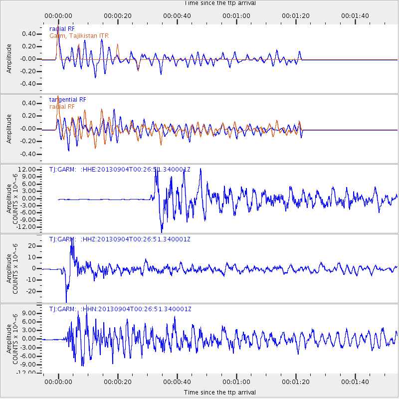
Earthquake location: Southeast Of Honshu, Japan
Earthquake latitude/longitude: 29.9/138.8
Earthquake time(UTC): 2013/09/04 (247) 00:18:23 GMT
Earthquake Depth: 402 km
Earthquake Magnitude: 6.5 MWW, 6.5 MWW, 6.5 MWB, 6.5 MWC
Earthquake Catalog/Contributor: NEIC PDE/NEIC COMCAT
Network: TJ Tajikistan National Seismic Network
Station: GARM Garm, Tajikistan
Lat/Lon: 39.00 N/70.32 E
Elevation: 1305 m
Distance: 56.0 deg
Az: 299.026 deg
Baz: 76.92 deg
Ray Param: 0.062895775
Estimated Moho Depth: 19.5 km
Estimated Crust Vp/Vs: 2.08
Assumed Crust Vp: 6.306 km/s
Estimated Crust Vs: 3.039 km/s
Estimated Crust Poisson's Ratio: 0.35
Radial Match: 87.242676 %
Radial Bump: 347
Transverse Match: 75.05049 %
Transverse Bump: 400
SOD ConfigId: 626651
Insert Time: 2014-04-18 09:25:57.384 +0000
GWidth: 2.5
Max Bumps: 400
Tol: 0.001

Signal To Noise

ChannelStoNSTALTA
TJ:GARM: :HHZ:20130904T00:26:51.340001Z85.231671.1503394E-51.349662E-7
TJ:GARM: :HHN:20130904T00:26:51.340001Z23.4355891.5933493E-66.7988445E-8
TJ:GARM: :HHE:20130904T00:26:51.340001Z68.5712055.4245857E-67.9108794E-8
Arrivals
Ps3.5 SECOND
PpPs9.1 SECOND
PsPs/PpSs13 SECOND