You are here: Home > Network List > WY - Yellowstone Wyoming Seismic Network Stations List
> Station YHH Holmes Hill, YNP, WY, USA > Earthquake Result Viewer
YHH Holmes Hill, YNP, WY, USA - Earthquake Result Viewer
*The percent match for this event was below the threshold and hence no stack was calculated.
| Earthquake location: |
Southeast Of Honshu, Japan |
| Earthquake latitude/longitude: |
29.9/138.8 |
| Earthquake time(UTC): |
2013/09/04 (247) 00:18:23 GMT |
| Earthquake Depth: |
402 km |
| Earthquake Magnitude: |
6.5 MWW, 6.5 MWW, 6.5 MWB, 6.5 MWC |
| Earthquake Catalog/Contributor: |
NEIC PDE/NEIC COMCAT |
|
| Network: |
WY Yellowstone Wyoming Seismic Network |
| Station: |
YHH Holmes Hill, YNP, WY, USA |
| Lat/Lon: |
44.79 N/110.85 W |
| Elevation: |
2717 m |
|
| Distance: |
82.3 deg |
| Az: |
42.365 deg |
| Baz: |
304.773 deg |
| Ray Param: |
$rayparam |
*The percent match for this event was below the threshold and hence was not used in the summary stack. |
|
| Radial Match: |
50.50109 % |
| Radial Bump: |
400 |
| Transverse Match: |
11.570179 % |
| Transverse Bump: |
201 |
| SOD ConfigId: |
626651 |
| Insert Time: |
2014-04-18 09:27:59.511 +0000 |
| GWidth: |
2.5 |
| Max Bumps: |
400 |
| Tol: |
0.001 |
|
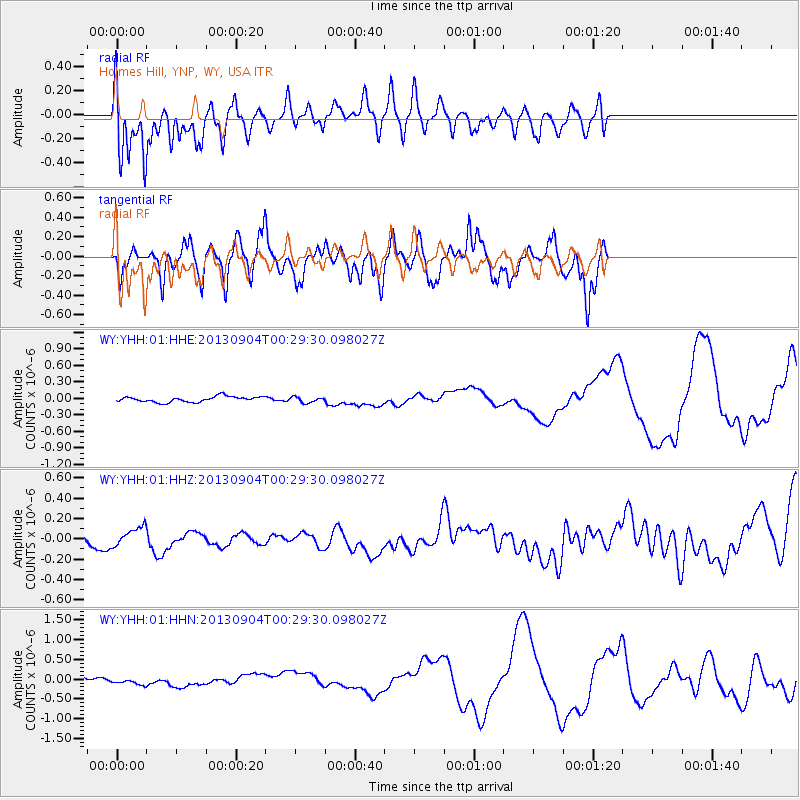
Signal To Noise
| Channel | StoN | STA | LTA |
| WY:YHH:01:HHZ:20130904T00:29:30.098027Z | 2.0937853 | 9.3020844E-8 | 4.4427114E-8 |
| WY:YHH:01:HHN:20130904T00:29:30.098027Z | 1.8193529 | 9.6277034E-8 | 5.2918285E-8 |
| WY:YHH:01:HHE:20130904T00:29:30.098027Z | 1.0067885 | 5.0708415E-8 | 5.0366502E-8 |
| Arrivals |
| Ps | |
| PpPs | |
| PsPs/PpSs | |


