You are here: Home > Network List > TA - USArray Transportable Network (new EarthScope stations) Stations List
> Station 254A Abbeville, GA, USA > Earthquake Result Viewer
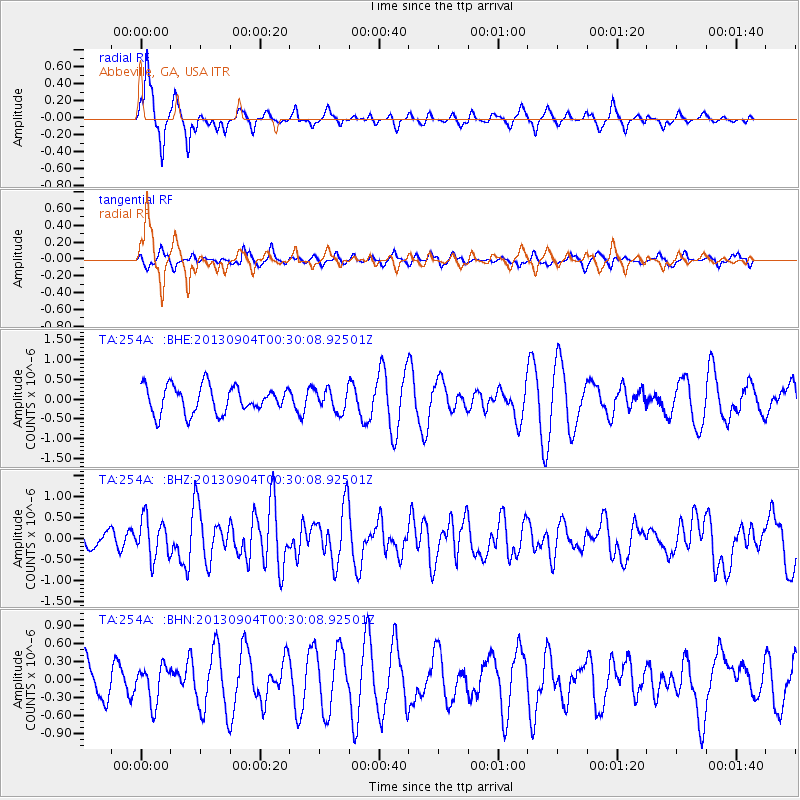
254A Abbeville, GA, USA - Earthquake Result Viewer
*The percent match for this event was below the threshold and hence no stack was calculated.
| Earthquake location: |
Queen Charlotte Islands Region |
| Earthquake latitude/longitude: |
51.2/-130.2 |
| Earthquake time(UTC): |
2013/09/04 (247) 00:23:11 GMT |
| Earthquake Depth: |
9.9 km |
| Earthquake Magnitude: |
6.0 MW, 5.9 MI, 5.9 MWR, 6.0 MWW, 6.0 MWW, 6.0 MWC |
| Earthquake Catalog/Contributor: |
NEIC PDE/NEIC COMCAT |
|
| Network: |
TA USArray Transportable Network (new EarthScope stations) |
| Station: |
254A Abbeville, GA, USA |
| Lat/Lon: |
31.95 N/83.29 W |
| Elevation: |
78 m |
|
| Distance: |
39.2 deg |
| Az: |
100.909 deg |
| Baz: |
313.368 deg |
| Ray Param: |
$rayparam |
*The percent match for this event was below the threshold and hence was not used in the summary stack. |
|
| Radial Match: |
79.12372 % |
| Radial Bump: |
356 |
| Transverse Match: |
66.084236 % |
| Transverse Bump: |
400 |
| SOD ConfigId: |
626651 |
| Insert Time: |
2014-04-18 09:38:29.689 +0000 |
| GWidth: |
2.5 |
| Max Bumps: |
400 |
| Tol: |
0.001 |
|
Signal To Noise
| Channel | StoN | STA | LTA |
| TA:254A: :BHZ:20130904T00:30:08.92501Z | 3.0537124 | 4.6629728E-7 | 1.526985E-7 |
| TA:254A: :BHN:20130904T00:30:08.92501Z | 1.3813244 | 3.033657E-7 | 2.1961947E-7 |
| TA:254A: :BHE:20130904T00:30:08.92501Z | 0.8346977 | 2.8226694E-7 | 3.3816667E-7 |
| Arrivals |
| Ps | |
| PpPs | |
| PsPs/PpSs | |


