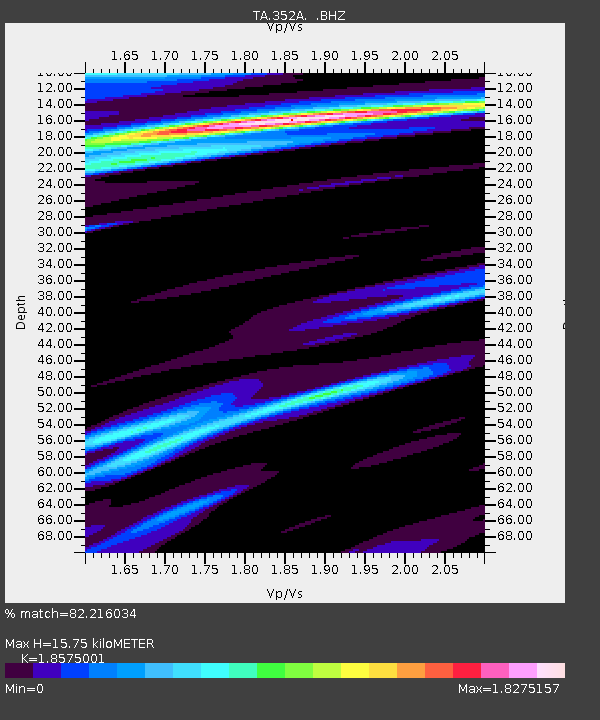
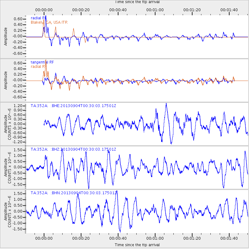
352A Blakely, GA, USA - Earthquake Result Viewer

Earthquake location: Queen Charlotte Islands Region
Earthquake latitude/longitude: 51.2/-130.2
Earthquake time(UTC): 2013/09/04 (247) 00:23:11 GMT
Earthquake Depth: 9.9 km
Earthquake Magnitude: 6.0 MW, 5.9 MI, 5.9 MWR, 6.0 MWW, 6.0 MWW, 6.0 MWC
Earthquake Catalog/Contributor: NEIC PDE/NEIC COMCAT
Network: TA USArray Transportable Network (new EarthScope stations)
Station: 352A Blakely, GA, USA
Lat/Lon: 31.48 N/84.93 W
Elevation: 101 m
Distance: 38.5 deg
Az: 102.98 deg
Baz: 314.124 deg
Ray Param: 0.075497754
Estimated Moho Depth: 15.75 km
Estimated Crust Vp/Vs: 1.86
Assumed Crust Vp: 6.347 km/s
Estimated Crust Vs: 3.417 km/s
Estimated Crust Poisson's Ratio: 0.30
Radial Match: 82.216034 %
Radial Bump: 263
Transverse Match: 62.60609 %
Transverse Bump: 374
SOD ConfigId: 626651
Insert Time: 2014-04-18 09:38:37.468 +0000
GWidth: 2.5
Max Bumps: 400
Tol: 0.001

Signal To Noise

ChannelStoNSTALTA
TA:352A: :BHZ:20130904T00:30:03.17501Z3.2160245.671628E-71.7635526E-7
TA:352A: :BHN:20130904T00:30:03.17501Z1.2229142.2628043E-71.8503381E-7
TA:352A: :BHE:20130904T00:30:03.17501Z0.81225762.7080634E-73.3339956E-7
Arrivals
Ps2.3 SECOND
PpPs6.6 SECOND
PsPs/PpSs8.9 SECOND