You are here: Home > Network List > TA - USArray Transportable Network (new EarthScope stations) Stations List
> Station H46A Fife Lake, MI, USA > Earthquake Result Viewer
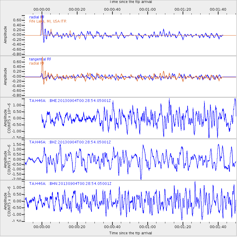
H46A Fife Lake, MI, USA - Earthquake Result Viewer
*The percent match for this event was below the threshold and hence no stack was calculated.
| Earthquake location: |
Queen Charlotte Islands Region |
| Earthquake latitude/longitude: |
51.2/-130.2 |
| Earthquake time(UTC): |
2013/09/04 (247) 00:23:11 GMT |
| Earthquake Depth: |
9.9 km |
| Earthquake Magnitude: |
6.0 MW, 5.9 MI, 5.9 MWR, 6.0 MWW, 6.0 MWW, 6.0 MWC |
| Earthquake Catalog/Contributor: |
NEIC PDE/NEIC COMCAT |
|
| Network: |
TA USArray Transportable Network (new EarthScope stations) |
| Station: |
H46A Fife Lake, MI, USA |
| Lat/Lon: |
44.54 N/85.20 W |
| Elevation: |
329 m |
|
| Distance: |
30.5 deg |
| Az: |
84.676 deg |
| Baz: |
298.798 deg |
| Ray Param: |
$rayparam |
*The percent match for this event was below the threshold and hence was not used in the summary stack. |
|
| Radial Match: |
76.91264 % |
| Radial Bump: |
400 |
| Transverse Match: |
53.321568 % |
| Transverse Bump: |
400 |
| SOD ConfigId: |
626651 |
| Insert Time: |
2014-04-18 09:39:51.578 +0000 |
| GWidth: |
2.5 |
| Max Bumps: |
400 |
| Tol: |
0.001 |
|
Signal To Noise
| Channel | StoN | STA | LTA |
| TA:H46A: :BHZ:20130904T00:28:54.05001Z | 3.2961128 | 5.6539324E-7 | 1.7153333E-7 |
| TA:H46A: :BHN:20130904T00:28:54.05001Z | 1.531778 | 2.5039904E-7 | 1.6346955E-7 |
| TA:H46A: :BHE:20130904T00:28:54.05001Z | 1.4103945 | 3.851929E-7 | 2.7311003E-7 |
| Arrivals |
| Ps | |
| PpPs | |
| PsPs/PpSs | |


