K48A Perry, MI, USA - Earthquake Result Viewer
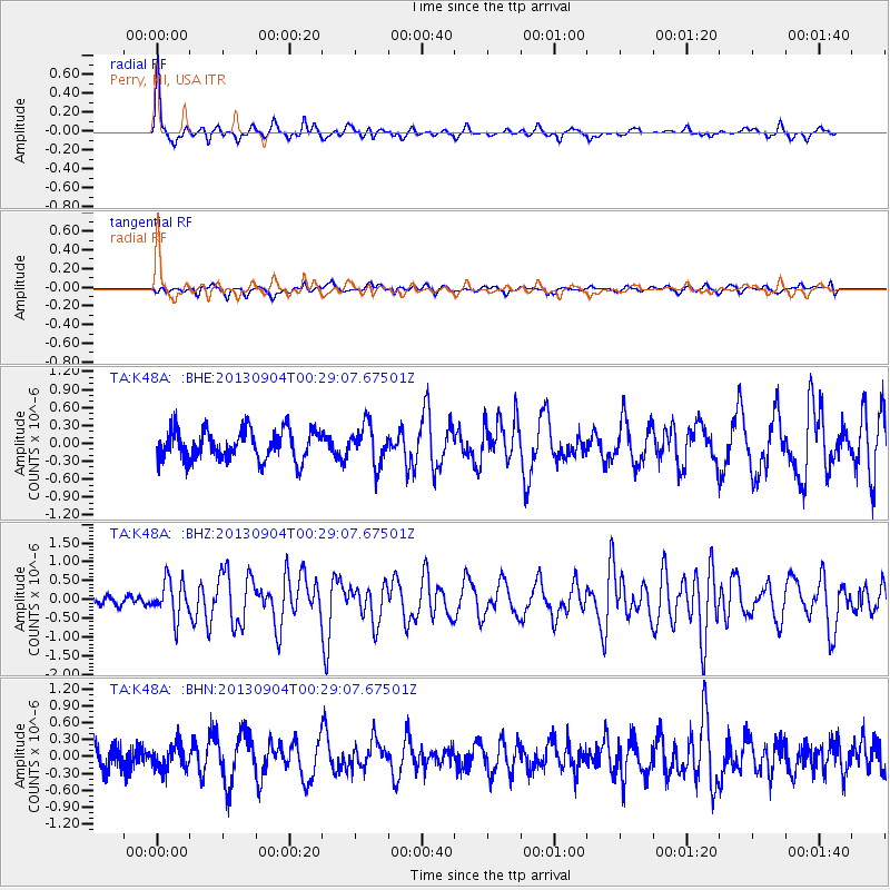
Earthquake location: Queen Charlotte Islands Region
Earthquake latitude/longitude: 51.2/-130.2
Earthquake time(UTC): 2013/09/04 (247) 00:23:11 GMT
Earthquake Depth: 9.9 km
Earthquake Magnitude: 6.0 MW, 5.9 MI, 5.9 MWR, 6.0 MWW, 6.0 MWW, 6.0 MWC
Earthquake Catalog/Contributor: NEIC PDE/NEIC COMCAT
Network: TA USArray Transportable Network (new EarthScope stations)
Station: K48A Perry, MI, USA
Lat/Lon: 42.80 N/84.12 W
Elevation: 273 m
Distance: 32.1 deg
Az: 86.808 deg
Baz: 301.366 deg
Ray Param: 0.07880237
Estimated Moho Depth: 50.0 km
Estimated Crust Vp/Vs: 2.09
Assumed Crust Vp: 6.483 km/s
Estimated Crust Vs: 3.105 km/s
Estimated Crust Poisson's Ratio: 0.35
Radial Match: 83.08391 %
Radial Bump: 311
Transverse Match: 44.96647 %
Transverse Bump: 400
SOD ConfigId: 626651
Insert Time: 2014-04-18 09:40:28.196 +0000
GWidth: 2.5
Max Bumps: 400
Tol: 0.001

Signal To Noise

ChannelStoNSTALTA
TA:K48A: :BHZ:20130904T00:29:07.67501Z2.6546074.9709655E-71.8725807E-7
TA:K48A: :BHN:20130904T00:29:07.67501Z0.98070252.147646E-72.1899056E-7
TA:K48A: :BHE:20130904T00:29:07.67501Z1.28845363.2032315E-72.4861055E-7
Arrivals
Ps9.0 SECOND
PpPs22 SECOND
PsPs/PpSs31 SECOND