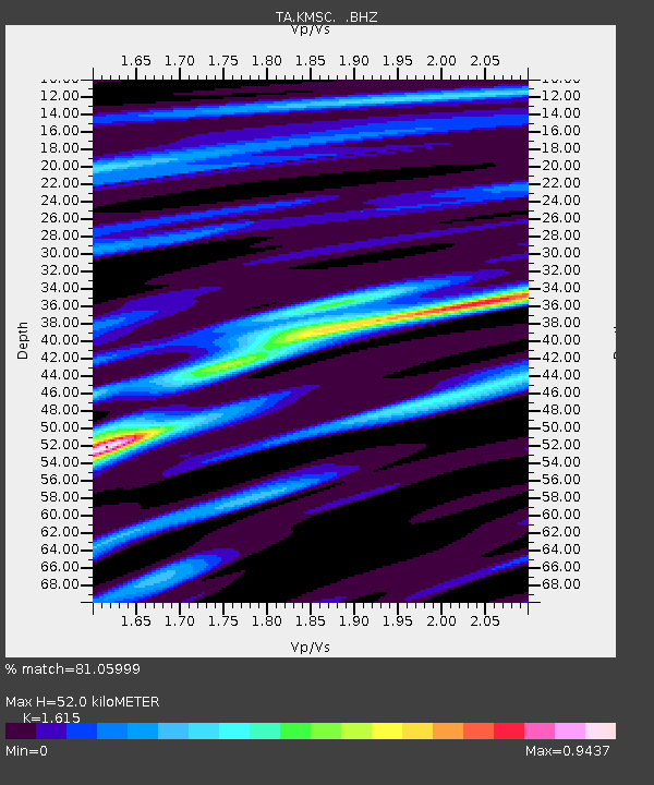
KMSC Kings Mountain, Blacksburg, SC, USA - Earthquake Result Viewer
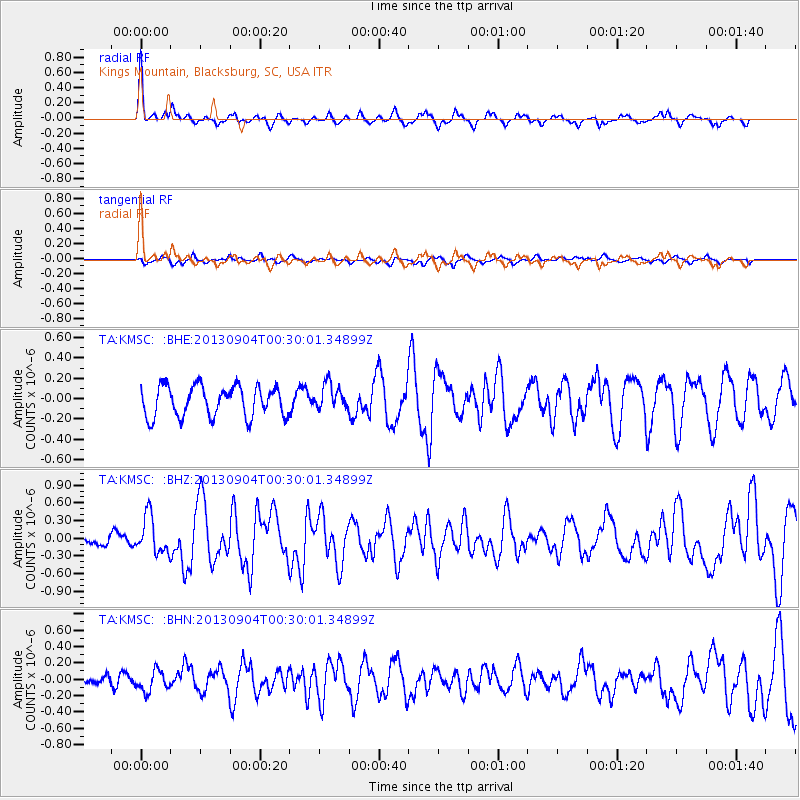
Earthquake location: Queen Charlotte Islands Region
Earthquake latitude/longitude: 51.2/-130.2
Earthquake time(UTC): 2013/09/04 (247) 00:23:11 GMT
Earthquake Depth: 9.9 km
Earthquake Magnitude: 6.0 MW, 5.9 MI, 5.9 MWR, 6.0 MWW, 6.0 MWW, 6.0 MWC
Earthquake Catalog/Contributor: NEIC PDE/NEIC COMCAT
Network: TA USArray Transportable Network (new EarthScope stations)
Station: KMSC Kings Mountain, Blacksburg, SC, USA
Lat/Lon: 35.14 N/81.33 W
Elevation: 240 m
Distance: 38.3 deg
Az: 95.373 deg
Baz: 310.129 deg
Ray Param: 0.075623274
Estimated Moho Depth: 52.0 km
Estimated Crust Vp/Vs: 1.62
Assumed Crust Vp: 6.419 km/s
Estimated Crust Vs: 3.975 km/s
Estimated Crust Poisson's Ratio: 0.19
Radial Match: 81.05999 %
Radial Bump: 361
Transverse Match: 59.921246 %
Transverse Bump: 400
SOD ConfigId: 626651
Insert Time: 2014-04-18 09:40:38.397 +0000
GWidth: 2.5
Max Bumps: 400
Tol: 0.001

Signal To Noise

ChannelStoNSTALTA
TA:KMSC: :BHZ:20130904T00:30:01.34899Z2.8723683.139011E-71.09283036E-7
TA:KMSC: :BHN:20130904T00:30:01.34899Z1.48620211.2723801E-78.561285E-8
TA:KMSC: :BHE:20130904T00:30:01.34899Z0.82980691.2466023E-71.50228E-7
Arrivals
Ps5.4 SECOND
PpPs20 SECOND
PsPs/PpSs25 SECOND