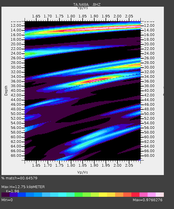
N48A Decatur, IN, USA - Earthquake Result Viewer
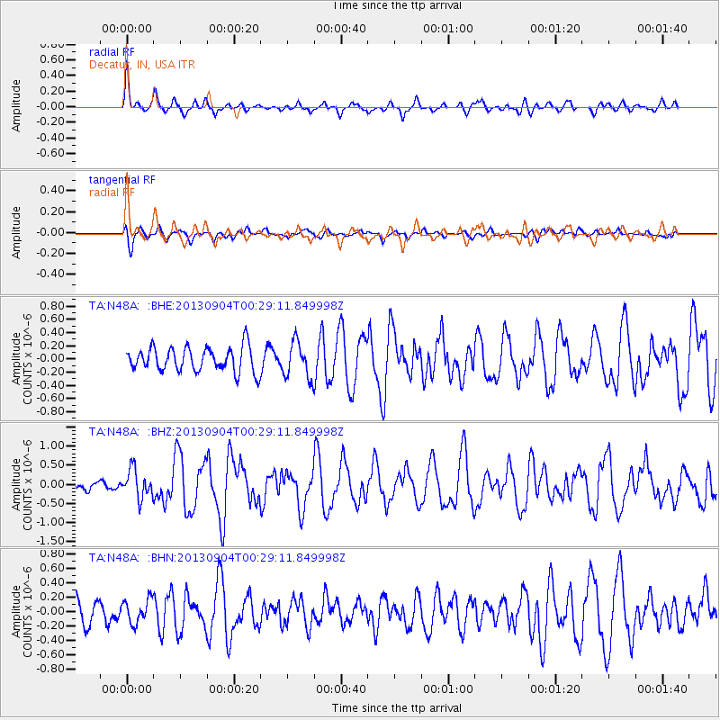
Earthquake location: Queen Charlotte Islands Region
Earthquake latitude/longitude: 51.2/-130.2
Earthquake time(UTC): 2013/09/04 (247) 00:23:11 GMT
Earthquake Depth: 9.9 km
Earthquake Magnitude: 6.0 MW, 5.9 MI, 5.9 MWR, 6.0 MWW, 6.0 MWW, 6.0 MWC
Earthquake Catalog/Contributor: NEIC PDE/NEIC COMCAT
Network: TA USArray Transportable Network (new EarthScope stations)
Station: N48A Decatur, IN, USA
Lat/Lon: 40.86 N/85.03 W
Elevation: 250 m
Distance: 32.6 deg
Az: 90.551 deg
Baz: 303.927 deg
Ray Param: 0.07859947
Estimated Moho Depth: 12.75 km
Estimated Crust Vp/Vs: 1.96
Assumed Crust Vp: 6.498 km/s
Estimated Crust Vs: 3.315 km/s
Estimated Crust Poisson's Ratio: 0.32
Radial Match: 80.64579 %
Radial Bump: 341
Transverse Match: 67.54069 %
Transverse Bump: 400
SOD ConfigId: 626651
Insert Time: 2014-04-18 09:41:12.285 +0000
GWidth: 2.5
Max Bumps: 400
Tol: 0.001

Signal To Noise

ChannelStoNSTALTA
TA:N48A: :BHZ:20130904T00:29:11.849998Z2.6188323.767315E-71.4385478E-7
TA:N48A: :BHN:20130904T00:29:11.849998Z1.25888381.675259E-71.3307493E-7
TA:N48A: :BHE:20130904T00:29:11.849998Z1.48197592.7393182E-71.8484228E-7
Arrivals
Ps2.0 SECOND
PpPs5.4 SECOND
PsPs/PpSs7.4 SECOND