
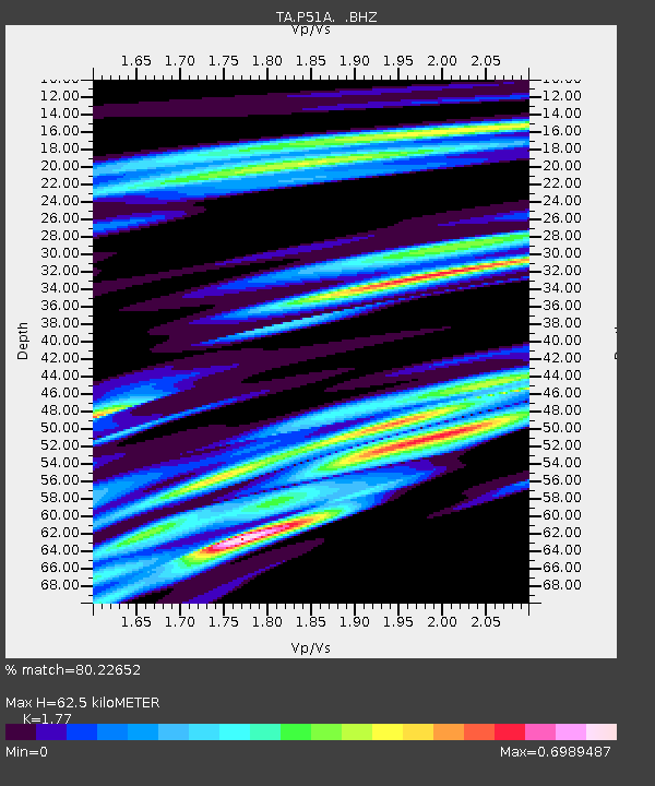
P51A Williamsport, OH, USA - Earthquake Result Viewer
| ||||||||||||||||||
| ||||||||||||||||||
| ||||||||||||||||||
|
Signal To Noise
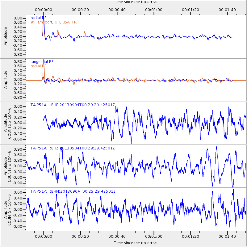
| Channel | StoN | STA | LTA |
| TA:P51A: :BHZ:20130904T00:29:29.42501Z | 2.6688774 | 3.036421E-7 | 1.1377147E-7 |
| TA:P51A: :BHN:20130904T00:29:29.42501Z | 1.2601413 | 1.895385E-7 | 1.5041051E-7 |
| TA:P51A: :BHE:20130904T00:29:29.42501Z | 1.3038379 | 1.4788756E-7 | 1.1342481E-7 |
| Arrivals | |
| Ps | 8.3 SECOND |
| PpPs | 26 SECOND |
| PsPs/PpSs | 34 SECOND |

