
R55A Marlinton, WV, USA - Earthquake Result Viewer
| ||||||||||||||||||
| ||||||||||||||||||
| ||||||||||||||||||
|
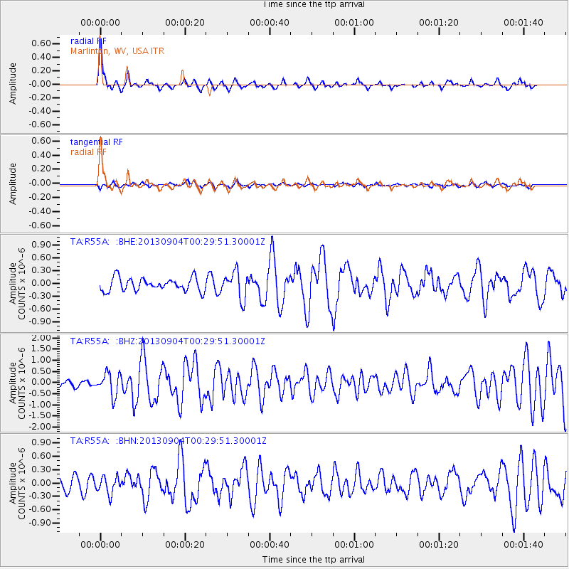
Signal To Noise
| Channel | StoN | STA | LTA |
| TA:R55A: :BHZ:20130904T00:29:51.30001Z | 2.611747 | 5.1898274E-7 | 1.9871095E-7 |
| TA:R55A: :BHN:20130904T00:29:51.30001Z | 1.5148212 | 1.9609135E-7 | 1.2944852E-7 |
| TA:R55A: :BHE:20130904T00:29:51.30001Z | 2.152761 | 3.2811622E-7 | 1.5241646E-7 |
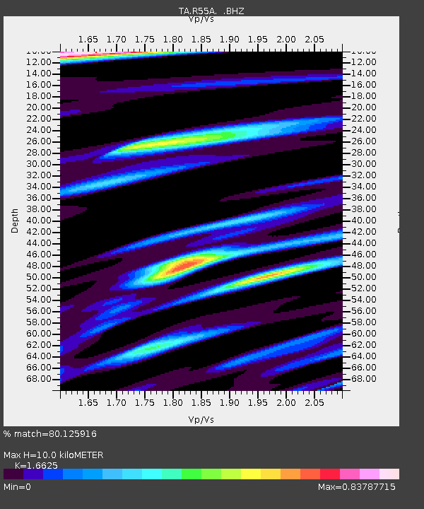
| Arrivals | |
| Ps | 1.1 SECOND |
| PpPs | 4.0 SECOND |
| PsPs/PpSs | 5.1 SECOND |

