
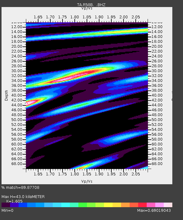
R58B Mineral, VA, USA - Earthquake Result Viewer
| ||||||||||||||||||
| ||||||||||||||||||
| ||||||||||||||||||
|
Signal To Noise
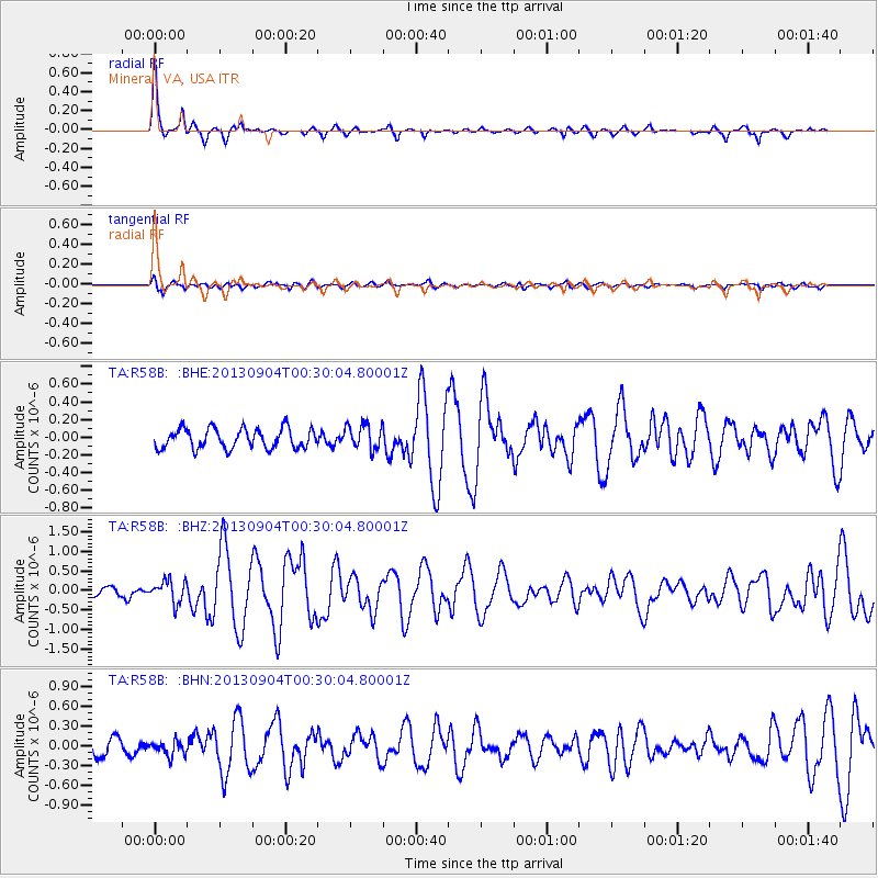
| Channel | StoN | STA | LTA |
| TA:R58B: :BHZ:20130904T00:30:04.80001Z | 2.6372998 | 2.8741258E-7 | 1.0897986E-7 |
| TA:R58B: :BHN:20130904T00:30:04.80001Z | 1.0587269 | 1.12634815E-7 | 1.06387034E-7 |
| TA:R58B: :BHE:20130904T00:30:04.80001Z | 1.2323685 | 1.3802433E-7 | 1.11999235E-7 |
| Arrivals | |
| Ps | 4.3 SECOND |
| PpPs | 16 SECOND |
| PsPs/PpSs | 20 SECOND |

