
SFIN Lafayette, IN, USA - Earthquake Result Viewer
| ||||||||||||||||||
| ||||||||||||||||||
| ||||||||||||||||||
|
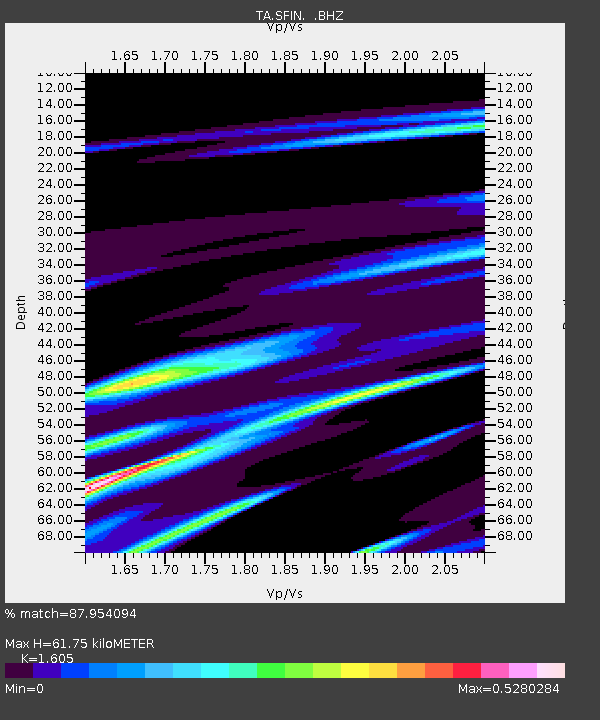
Signal To Noise
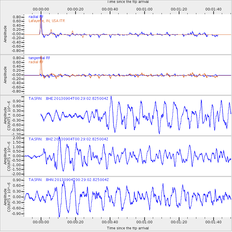
| Channel | StoN | STA | LTA |
| TA:SFIN: :BHZ:20130904T00:29:02.825004Z | 3.329301 | 3.8538028E-7 | 1.15754105E-7 |
| TA:SFIN: :BHN:20130904T00:29:02.825004Z | 1.1563451 | 1.6851511E-7 | 1.4573082E-7 |
| TA:SFIN: :BHE:20130904T00:29:02.825004Z | 1.6318988 | 2.324567E-7 | 1.4244554E-7 |
| Arrivals | |
| Ps | 6.3 SECOND |
| PpPs | 23 SECOND |
| PsPs/PpSs | 29 SECOND |

