T52A Hallie, KY, USA - Earthquake Result Viewer
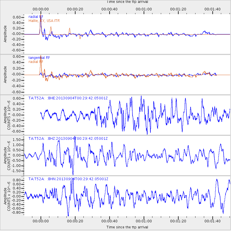
Earthquake location: Queen Charlotte Islands Region
Earthquake latitude/longitude: 51.2/-130.2
Earthquake time(UTC): 2013/09/04 (247) 00:23:11 GMT
Earthquake Depth: 9.9 km
Earthquake Magnitude: 6.0 MW, 5.9 MI, 5.9 MWR, 6.0 MWW, 6.0 MWW, 6.0 MWC
Earthquake Catalog/Contributor: NEIC PDE/NEIC COMCAT
Network: TA USArray Transportable Network (new EarthScope stations)
Station: T52A Hallie, KY, USA
Lat/Lon: 37.11 N/82.99 W
Elevation: 436 m
Distance: 36.1 deg
Az: 94.257 deg
Baz: 308.27 deg
Ray Param: 0.076889
Estimated Moho Depth: 16.0 km
Estimated Crust Vp/Vs: 1.76
Assumed Crust Vp: 6.476 km/s
Estimated Crust Vs: 3.669 km/s
Estimated Crust Poisson's Ratio: 0.26
Radial Match: 85.09947 %
Radial Bump: 400
Transverse Match: 43.710384 %
Transverse Bump: 400
SOD ConfigId: 626651
Insert Time: 2014-04-18 09:43:13.499 +0000
GWidth: 2.5
Max Bumps: 400
Tol: 0.001

Signal To Noise

ChannelStoNSTALTA
TA:T52A: :BHZ:20130904T00:29:42.05001Z4.67104435.035666E-71.07806E-7
TA:T52A: :BHN:20130904T00:29:42.05001Z1.19464312.1177989E-71.772746E-7
TA:T52A: :BHE:20130904T00:29:42.05001Z1.58829281.7776946E-71.1192487E-7
Arrivals
Ps2.0 SECOND
PpPs6.3 SECOND
PsPs/PpSs8.4 SECOND