
T54A Tazewell, VA, USA - Earthquake Result Viewer
| ||||||||||||||||||
| ||||||||||||||||||
| ||||||||||||||||||
|
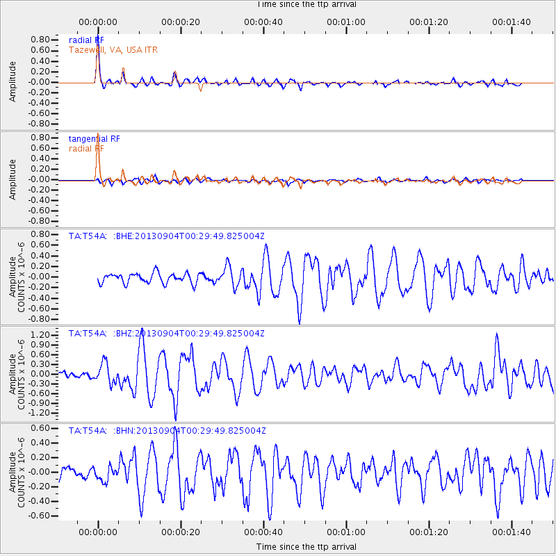
Signal To Noise
| Channel | StoN | STA | LTA |
| TA:T54A: :BHZ:20130904T00:29:49.825004Z | 2.8775828 | 3.1175279E-7 | 1.08338426E-7 |
| TA:T54A: :BHN:20130904T00:29:49.825004Z | 0.95772773 | 9.778304E-8 | 1.02098994E-7 |
| TA:T54A: :BHE:20130904T00:29:49.825004Z | 2.0244792 | 1.8912706E-7 | 9.3420105E-8 |
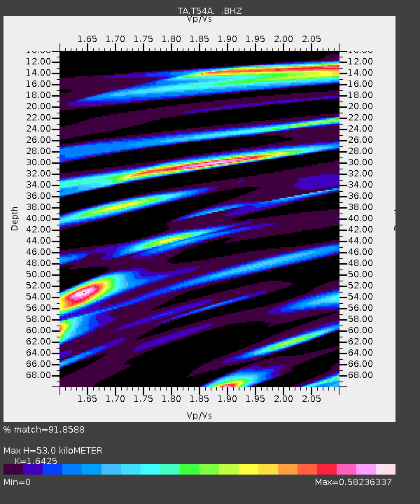
| Arrivals | |
| Ps | 5.9 SECOND |
| PpPs | 21 SECOND |
| PsPs/PpSs | 27 SECOND |

