T56A Rocky Mt, VA, USA - Earthquake Result Viewer
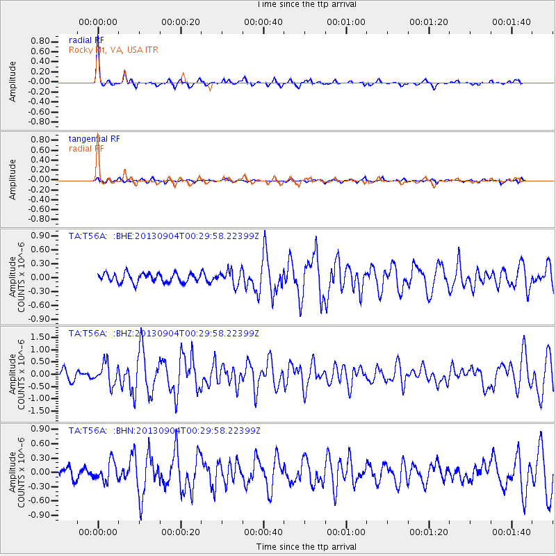
Earthquake location: Queen Charlotte Islands Region
Earthquake latitude/longitude: 51.2/-130.2
Earthquake time(UTC): 2013/09/04 (247) 00:23:11 GMT
Earthquake Depth: 9.9 km
Earthquake Magnitude: 6.0 MW, 5.9 MI, 5.9 MWR, 6.0 MWW, 6.0 MWW, 6.0 MWC
Earthquake Catalog/Contributor: NEIC PDE/NEIC COMCAT
Network: TA USArray Transportable Network (new EarthScope stations)
Station: T56A Rocky Mt, VA, USA
Lat/Lon: 37.03 N/80.03 W
Elevation: 387 m
Distance: 38.0 deg
Az: 91.931 deg
Baz: 308.185 deg
Ray Param: 0.075837955
Estimated Moho Depth: 46.75 km
Estimated Crust Vp/Vs: 1.80
Assumed Crust Vp: 6.159 km/s
Estimated Crust Vs: 3.417 km/s
Estimated Crust Poisson's Ratio: 0.28
Radial Match: 91.35841 %
Radial Bump: 251
Transverse Match: 64.50921 %
Transverse Bump: 400
SOD ConfigId: 626651
Insert Time: 2014-04-18 09:43:21.528 +0000
GWidth: 2.5
Max Bumps: 400
Tol: 0.001

Signal To Noise

ChannelStoNSTALTA
TA:T56A: :BHZ:20130904T00:29:58.22399Z2.36988144.4485765E-71.8771304E-7
TA:T56A: :BHN:20130904T00:29:58.22399Z1.85201562.084036E-71.12528E-7
TA:T56A: :BHE:20130904T00:29:58.22399Z1.67095891.6540815E-79.8989965E-8
Arrivals
Ps6.5 SECOND
PpPs20 SECOND
PsPs/PpSs26 SECOND